
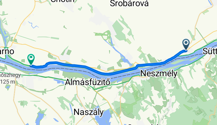
Moča - Veľký Harčáš
A cycling route starting in Süttő, Komárom-Esztergom, Hungary.
Overview
About this route
- 56 min
- Duration
- 18.3 km
- Distance
- 13 m
- Ascent
- 13 m
- Descent
- 19.6 km/h
- Avg. speed
- 114 m
- Max. altitude
Route quality
Waytypes & surfaces along the route
Waytypes
Cycleway
12.1 km
(66 %)
Quiet road
0.7 km
(4 %)
Undefined
5.5 km
(30 %)
Surfaces
Paved
17.9 km
(98 %)
Asphalt
17.9 km
(98 %)
Undefined
0.4 km
(2 %)
Continue with Bikemap
Use, edit, or download this cycling route
You would like to ride Moča - Veľký Harčáš or customize it for your own trip? Here is what you can do with this Bikemap route:
Free features
- Save this route as favorite or in collections
- Copy & plan your own version of this route
- Sync your route with Garmin or Wahoo
Premium features
Free trial for 3 days, or one-time payment. More about Bikemap Premium.
- Navigate this route on iOS & Android
- Export a GPX / KML file of this route
- Create your custom printout (try it for free)
- Download this route for offline navigation
Discover more Premium features.
Get Bikemap PremiumFrom our community
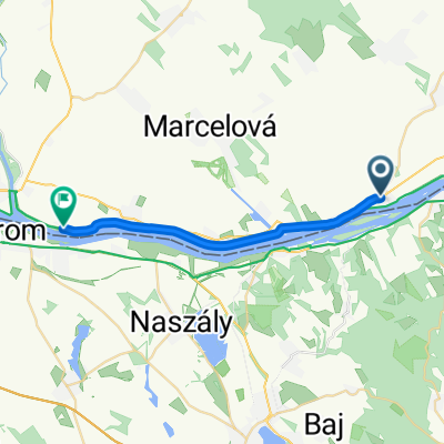
Other popular routes starting in Süttő
 Süttő-Naszály-Tata-Agostyán-Tardos-Süttő
- Distance
- 49.6 km
- Ascent
- 120 m
- Descent
- 105 m
- Location
- Süttő, Komárom-Esztergom, Hungary
 Süttő, kultúrotthon nach Sármány utca 7, Szentendre
- Distance
- 73.2 km
- Ascent
- 379 m
- Descent
- 363 m
- Location
- Süttő, Komárom-Esztergom, Hungary
 Zist Budapest Teil 3
- Distance
- 104.4 km
- Ascent
- 90 m
- Descent
- 90 m
- Location
- Süttő, Komárom-Esztergom, Hungary
 gere
gere- Distance
- 52.6 km
- Ascent
- 483 m
- Descent
- 483 m
- Location
- Süttő, Komárom-Esztergom, Hungary
 Moča - Veľký Harčáš
- Distance
- 18.3 km
- Ascent
- 13 m
- Descent
- 13 m
- Location
- Süttő, Komárom-Esztergom, Hungary
 Süttő-Tát-Bajna-Bajót-Lábatlan-Süttő
- Distance
- 48.3 km
- Ascent
- 312 m
- Descent
- 312 m
- Location
- Süttő, Komárom-Esztergom, Hungary
 kezdés
- Distance
- 46.1 km
- Ascent
- 397 m
- Descent
- 388 m
- Location
- Süttő, Komárom-Esztergom, Hungary
 Süttő-Eszt.-Dorog-Bajna-Héreg-Tarján-Tardos-Süttő
- Distance
- 85.8 km
- Ascent
- 380 m
- Descent
- 380 m
- Location
- Süttő, Komárom-Esztergom, Hungary
Open it in the app