
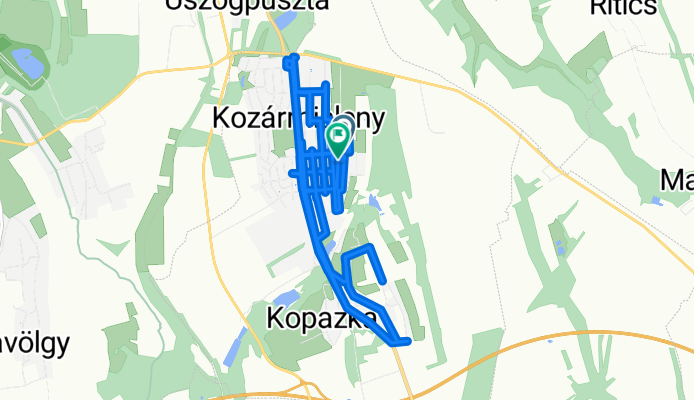
Csikósvölgy utca - Csikósvölgy utca
A cycling route starting in Kozármisleny, Baranya, Hungary.
Overview
About this route
- 4 h 19 min
- Duration
- 22.8 km
- Distance
- 166 m
- Ascent
- 214 m
- Descent
- 5.3 km/h
- Avg. speed
- 225 m
- Max. altitude

Route photos


Continue with Bikemap
Use, edit, or download this cycling route
You would like to ride Csikósvölgy utca - Csikósvölgy utca or customize it for your own trip? Here is what you can do with this Bikemap route:
Free features
- Save this route as favorite or in collections
- Copy & plan your own version of this route
- Sync your route with Garmin or Wahoo
Premium features
Free trial for 3 days, or one-time payment. More about Bikemap Premium.
- Navigate this route on iOS & Android
- Export a GPX / KML file of this route
- Create your custom printout (try it for free)
- Download this route for offline navigation
Discover more Premium features.
Get Bikemap PremiumFrom our community
Other popular routes starting in Kozármisleny
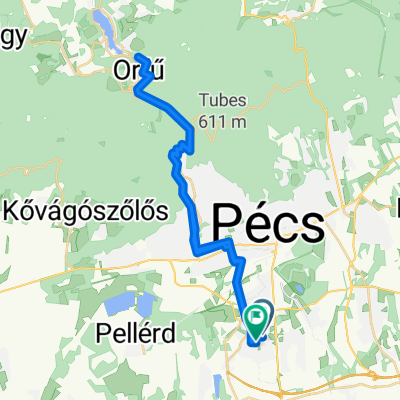 Nyugati Kőhíd dűlő, Pécs - Polgárszőlő utca, Pécs
- Distance
- 39.6 km
- Ascent
- 713 m
- Descent
- 723 m
- Location
- Kozármisleny, Baranya, Hungary
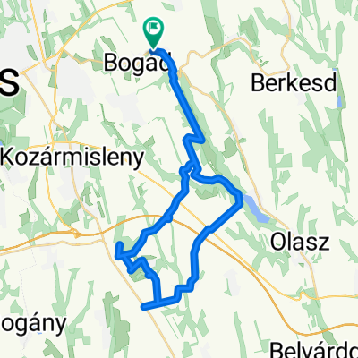
 Gasztro 2017
- Distance
- 57.1 km
- Ascent
- 676 m
- Descent
- 676 m
- Location
- Kozármisleny, Baranya, Hungary
 Csikósvölgy utca - Csikósvölgy utca
- Distance
- 9.9 km
- Ascent
- 62 m
- Descent
- 111 m
- Location
- Kozármisleny, Baranya, Hungary
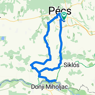
 Lassú utazás
- Distance
- 35.5 km
- Ascent
- 366 m
- Descent
- 412 m
- Location
- Kozármisleny, Baranya, Hungary
 Áeü Szaporca
- Distance
- 106.5 km
- Ascent
- 314 m
- Descent
- 315 m
- Location
- Kozármisleny, Baranya, Hungary
 Csikósvölgy utca - Csikósvölgy utca
- Distance
- 22.8 km
- Ascent
- 166 m
- Descent
- 214 m
- Location
- Kozármisleny, Baranya, Hungary
 Nagyárpád-Baksa-Hetvehely-Nagyárpád
- Distance
- 78.6 km
- Ascent
- 445 m
- Descent
- 453 m
- Location
- Kozármisleny, Baranya, Hungary
 Könnyű út
- Distance
- 23.3 km
- Ascent
- 262 m
- Descent
- 302 m
- Location
- Kozármisleny, Baranya, Hungary
Open it in the app