![Ph0]에서 경로무거동 1214-3](/_next/static/media/contour-lines-light-small.cafd5e5d.avif)
![Ph0]에서 경로무거동 1214-3](https://media.bikemap.net/routes/17431612/staticmaps/in_19a596a2-defc-4a94-9e55-666b21332c14_694x400_bikemap-2021-3D-static.png)
Ph0]에서 경로무거동 1214-3
A cycling route starting in Ulsan, Ulsan, South Korea.
Overview
About this route
- 2 h 39 min
- Duration
- 33.6 km
- Distance
- 65 m
- Ascent
- 95 m
- Descent
- 12.7 km/h
- Avg. speed
- 39 m
- Max. altitude

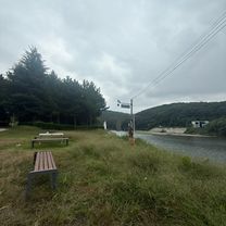
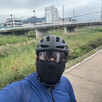
Route photos
![Photo 1 of the Bikemap route "Ph0]에서 경로무거동 1214-3"](https://media.bikemap.net/routes/17431612/gallery/thumbs/b6196cdc-ce6d-4182-b6f9-08898ddd916e.jpg.688x400_q80_crop.jpg "Photo 1 of the Bikemap route \"Ph0]에서 경로무거동 1214-3\"")
![Photo 2 of the Bikemap route "Ph0]에서 경로무거동 1214-3"](https://media.bikemap.net/routes/17431612/gallery/thumbs/62b455d8-a2bc-4e7b-b5cb-bce88b998515.jpg.688x400_q80_crop.jpg "Photo 2 of the Bikemap route \"Ph0]에서 경로무거동 1214-3\"")
![Photo 3 of the Bikemap route "Ph0]에서 경로무거동 1214-3"](https://media.bikemap.net/routes/17431612/gallery/thumbs/5bebdc20-53ca-4d4a-bff5-a0f0e9709e36.jpg.208x208_q80_crop.jpg "Photo 3 of the Bikemap route \"Ph0]에서 경로무거동 1214-3\"")
![Photo 4 of the Bikemap route "Ph0]에서 경로무거동 1214-3"](https://media.bikemap.net/routes/17431612/gallery/thumbs/79b0cb71-2a81-4280-83d5-95919e1ea1f7.jpg.208x208_q80_crop.jpg "Photo 4 of the Bikemap route \"Ph0]에서 경로무거동 1214-3\"")
![Photo 5 of the Bikemap route "Ph0]에서 경로무거동 1214-3"](https://media.bikemap.net/routes/17431612/gallery/thumbs/7bac5a7b-ffa5-49e4-b023-c86f0dcb28c6.jpg.208x208_q80_crop.jpg "Photo 5 of the Bikemap route \"Ph0]에서 경로무거동 1214-3\"")
![Photo 6 of the Bikemap route "Ph0]에서 경로무거동 1214-3"](https://media.bikemap.net/routes/17431612/gallery/thumbs/89ce1002-6833-496f-90d4-467ad733eb75.jpg.208x208_q80_crop.jpg "Photo 6 of the Bikemap route \"Ph0]에서 경로무거동 1214-3\"")
![Photo 7 of the Bikemap route "Ph0]에서 경로무거동 1214-3"](https://media.bikemap.net/routes/17431612/gallery/thumbs/9a5ee130-ef49-4eb2-b058-30aa512092d8.jpg.208x208_q80_crop.jpg "Photo 7 of the Bikemap route \"Ph0]에서 경로무거동 1214-3\"")
![Photo 8 of the Bikemap route "Ph0]에서 경로무거동 1214-3"](https://media.bikemap.net/routes/17431612/gallery/thumbs/d898caa8-d8a1-429c-8174-29e75079fb00.jpg.208x208_q80_crop.jpg "Photo 8 of the Bikemap route \"Ph0]에서 경로무거동 1214-3\"")
Continue with Bikemap
Use, edit, or download this cycling route
You would like to ride Ph0]에서 경로무거동 1214-3 or customize it for your own trip? Here is what you can do with this Bikemap route:
Free features
- Save this route as favorite or in collections
- Copy & plan your own version of this route
- Sync your route with Garmin or Wahoo
Premium features
Free trial for 3 days, or one-time payment. More about Bikemap Premium.
- Navigate this route on iOS & Android
- Export a GPX / KML file of this route
- Create your custom printout (try it for free)
- Download this route for offline navigation
Discover more Premium features.
Get Bikemap PremiumFrom our community
Other popular routes starting in Ulsan
 미포동 6-64 ~ 전하동 1-1
- Distance
- 29.4 km
- Ascent
- 2,186 m
- Descent
- 2,126 m
- Location
- Ulsan, Ulsan, South Korea
![Ph0]에서 경로달동 1355-10](https://media.bikemap.net/routes/17536503/gallery/thumbs/55e44673-ec29-4149-828c-68bb36b06268.jpg.208x208_q80_crop.jpg) Ph0]에서 경로달동 1355-10
Ph0]에서 경로달동 1355-10- Distance
- 9.1 km
- Ascent
- 80 m
- Descent
- 107 m
- Location
- Ulsan, Ulsan, South Korea
 ㅇㅇㅇㅇ어엉ㅇ
- Distance
- 21.1 km
- Ascent
- 279 m
- Descent
- 252 m
- Location
- Ulsan, Ulsan, South Korea
 송정동, 울산광역시에서 두동로, 울산광역시까지
- Distance
- 23.4 km
- Ascent
- 51 m
- Descent
- 78 m
- Location
- Ulsan, Ulsan, South Korea
![Ph0]에서 경로무거동 1214-3](https://media.bikemap.net/routes/17431612/gallery/thumbs/b6196cdc-ce6d-4182-b6f9-08898ddd916e.jpg.208x208_q80_crop.jpg) Ph0]에서 경로무거동 1214-3
Ph0]에서 경로무거동 1214-3- Distance
- 33.6 km
- Ascent
- 65 m
- Descent
- 95 m
- Location
- Ulsan, Ulsan, South Korea
 신정동, 울산광역시에서 신정동, 울산광역시까지
- Distance
- 50.2 km
- Ascent
- 303 m
- Descent
- 321 m
- Location
- Ulsan, Ulsan, South Korea
 신천동, 울산광역시에서 창평동, 울산광역시까지
- Distance
- 12.1 km
- Ascent
- 80 m
- Descent
- 75 m
- Location
- Ulsan, Ulsan, South Korea
![Ph0]에서 경로무거동 1214-3](https://media.bikemap.net/routes/17431618/gallery/thumbs/7b601797-044b-4890-adb9-1d22f098ee35.jpg.208x208_q80_crop.jpg) Ph0]에서 경로무거동 1214-3
Ph0]에서 경로무거동 1214-3- Distance
- 33.6 km
- Ascent
- 65 m
- Descent
- 95 m
- Location
- Ulsan, Ulsan, South Korea
Open it in the app