
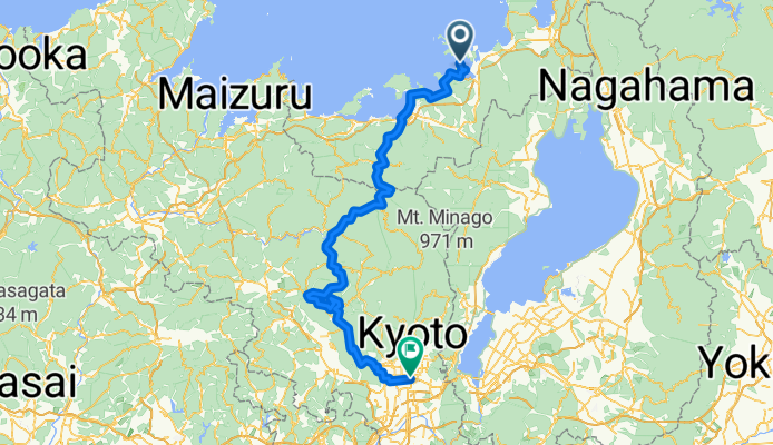
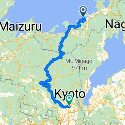
D7_b_KYOTO Passhunter
A cycling route starting in Obama, Fukui, Japan.
Overview
About this route
- 11 h 59 min
- Duration
- 147.3 km
- Distance
- 5,370 m
- Ascent
- 5,348 m
- Descent
- 12.3 km/h
- Avg. speed
- 603 m
- Max. altitude
Continue with Bikemap
Use, edit, or download this cycling route
You would like to ride D7_b_KYOTO Passhunter or customize it for your own trip? Here is what you can do with this Bikemap route:
Free features
- Save this route as favorite or in collections
- Copy & plan your own version of this route
- Split it into stages to create a multi-day tour
- Sync your route with Garmin or Wahoo
Premium features
Free trial for 3 days, or one-time payment. More about Bikemap Premium.
- Navigate this route on iOS & Android
- Export a GPX / KML file of this route
- Create your custom printout (try it for free)
- Download this route for offline navigation
Discover more Premium features.
Get Bikemap PremiumFrom our community
Other popular routes starting in Obama
 おおい赤礁崎コース
- Distance
- 15.4 km
- Ascent
- 502 m
- Descent
- 501 m
- Location
- Obama, Fukui, Japan
 日本遺産 鯖街道沿線 寺社めぐりコース~「海のある奈良」と呼ばれる小浜 里山の古刹を訪ねて~
- Distance
- 15.5 km
- Ascent
- 159 m
- Descent
- 157 m
- Location
- Obama, Fukui, Japan
 日本遺産 若狭の浦々に続く鯖街道 三方五湖コース~梅林と五色の湖に出会う、静かな湖畔の道~
- Distance
- 74.1 km
- Ascent
- 2,724 m
- Descent
- 2,723 m
- Location
- Obama, Fukui, Japan
 D7_b_KYOTO Passhunter
- Distance
- 147.3 km
- Ascent
- 5,370 m
- Descent
- 5,348 m
- Location
- Obama, Fukui, Japan
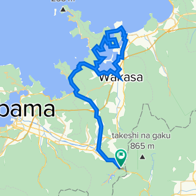
 WakasajiCR2015AfterplanA
- Distance
- 81.7 km
- Ascent
- 1,213 m
- Descent
- 1,126 m
- Location
- Obama, Fukui, Japan
 高浜音海コース
- Distance
- 14.4 km
- Ascent
- 257 m
- Descent
- 254 m
- Location
- Obama, Fukui, Japan
 122−31, 若狭町 to 122−31, 若狭町
- Distance
- 33.3 km
- Ascent
- 255 m
- Descent
- 254 m
- Location
- Obama, Fukui, Japan
 fukui tour
- Distance
- 48.4 km
- Ascent
- 675 m
- Descent
- 683 m
- Location
- Obama, Fukui, Japan
Open it in the app