
Sonntagstour 😄
A cycling route starting in Jückelberg, Thuringia, Germany.
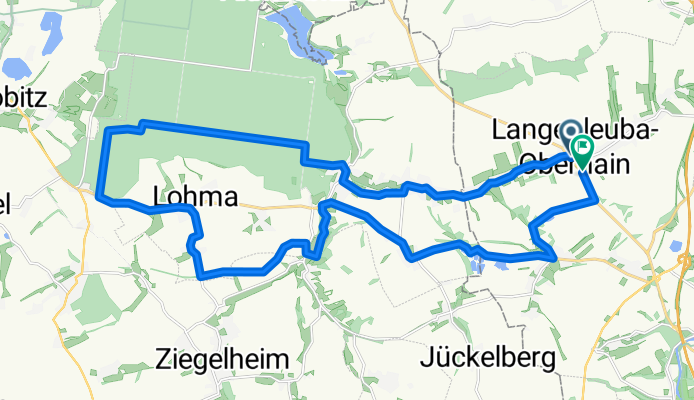
Overview
About this route
- 2 h 17 min
- Duration
- 29 km
- Distance
- 259 m
- Ascent
- 302 m
- Descent
- 12.6 km/h
- Avg. speed
- 267 m
- Max. altitude
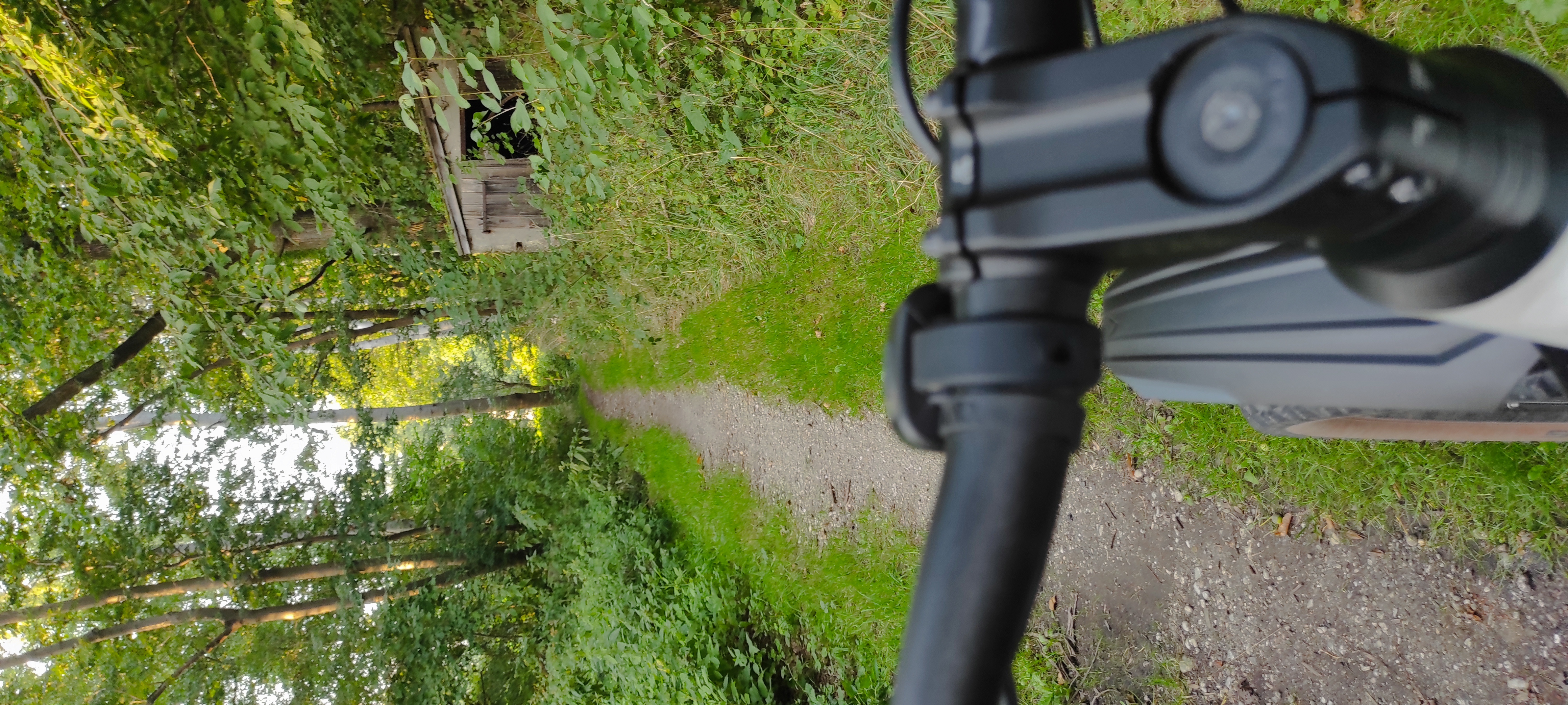
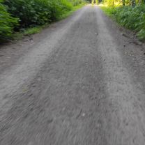
Route photos


Route quality
Waytypes & surfaces along the route
Waytypes
Road
11.9 km
(41 %)
Busy road
7.6 km
(26 %)
Surfaces
Paved
6.5 km
(23 %)
Unpaved
7.2 km
(25 %)
Asphalt
6 km
(21 %)
Loose gravel
3.1 km
(11 %)
Continue with Bikemap
Use, edit, or download this cycling route
You would like to ride Sonntagstour 😄 or customize it for your own trip? Here is what you can do with this Bikemap route:
Free features
- Save this route as favorite or in collections
- Copy & plan your own version of this route
- Sync your route with Garmin or Wahoo
Premium features
Free trial for 3 days, or one-time payment. More about Bikemap Premium.
- Navigate this route on iOS & Android
- Export a GPX / KML file of this route
- Create your custom printout (try it for free)
- Download this route for offline navigation
Discover more Premium features.
Get Bikemap PremiumFrom our community
Other popular routes starting in Jückelberg
 Dennheritz-Wolkenburg
- Distance
- 20.2 km
- Ascent
- 130 m
- Descent
- 77 m
- Location
- Jückelberg, Thuringia, Germany
 Remse
Remse- Distance
- 38.4 km
- Ascent
- 288 m
- Descent
- 262 m
- Location
- Jückelberg, Thuringia, Germany
 Thurm-Mulderadweg-Altenburg
- Distance
- 17.7 km
- Ascent
- 154 m
- Descent
- 209 m
- Location
- Jückelberg, Thuringia, Germany
 Sonntagstour 😄
- Distance
- 29 km
- Ascent
- 259 m
- Descent
- 302 m
- Location
- Jückelberg, Thuringia, Germany
 Steinbach-Burgstädt-Wechselburg-Kohren-Steinbach
- Distance
- 65.3 km
- Ascent
- 526 m
- Descent
- 524 m
- Location
- Jückelberg, Thuringia, Germany
 Tour 9
- Distance
- 39.3 km
- Ascent
- 347 m
- Descent
- 371 m
- Location
- Jückelberg, Thuringia, Germany
 Penig-Waldenburg Muldental Berg und Tal
- Distance
- 37.4 km
- Ascent
- 310 m
- Descent
- 310 m
- Location
- Jückelberg, Thuringia, Germany
 leinawald
- Distance
- 28.2 km
- Ascent
- 223 m
- Descent
- 267 m
- Location
- Jückelberg, Thuringia, Germany
Open it in the app