
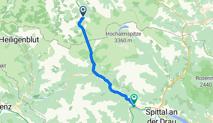
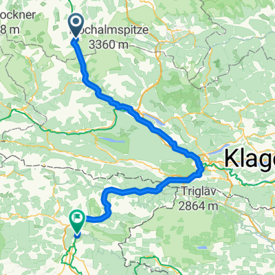
Bad Gastein - Möllbrücke
A cycling route starting in Bad Gastein, Salzburg, Austria.
Overview
About this route
- 2 h 40 min
- Duration
- 44.8 km
- Distance
- 585 m
- Ascent
- 1,119 m
- Descent
- 16.9 km/h
- Avg. speed
- 1,199 m
- Max. altitude
Route quality
Waytypes & surfaces along the route
Waytypes
Quiet road
15.7 km
(35 %)
Cycleway
13.9 km
(31 %)
Surfaces
Paved
11.6 km
(26 %)
Unpaved
4.9 km
(11 %)
Asphalt
10.8 km
(24 %)
Gravel
2.2 km
(5 %)
Continue with Bikemap
Use, edit, or download this cycling route
You would like to ride Bad Gastein - Möllbrücke or customize it for your own trip? Here is what you can do with this Bikemap route:
Free features
- Save this route as favorite or in collections
- Copy & plan your own version of this route
- Sync your route with Garmin or Wahoo
Premium features
Free trial for 3 days, or one-time payment. More about Bikemap Premium.
- Navigate this route on iOS & Android
- Export a GPX / KML file of this route
- Create your custom printout (try it for free)
- Download this route for offline navigation
Discover more Premium features.
Get Bikemap PremiumFrom our community
Other popular routes starting in Bad Gastein
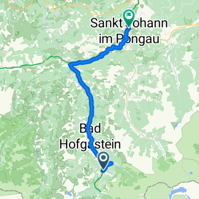 Bad Gastein - St Johann im Pongau
- Distance
- 42.8 km
- Ascent
- 536 m
- Descent
- 1,026 m
- Location
- Bad Gastein, Salzburg, Austria
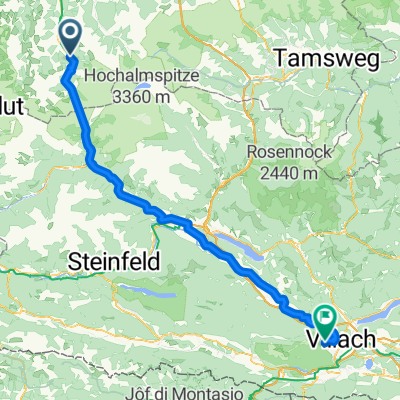
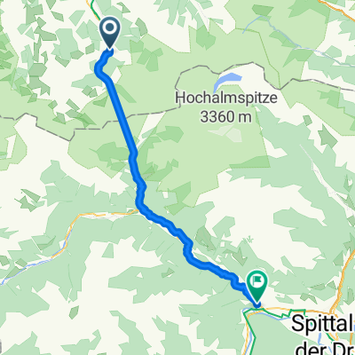
 Etappe 3: Von Bad Gastein nach Spittal an der Drau– Alpe-Adria-Radweg
- Distance
- 64 km
- Ascent
- 1,819 m
- Descent
- 2,351 m
- Location
- Bad Gastein, Salzburg, Austria
 Erlengrund camp-Gerli camp (Villach) 103 km
- Distance
- 102.8 km
- Ascent
- 1,339 m
- Descent
- 1,640 m
- Location
- Bad Gastein, Salzburg, Austria
 Ei Rastötzen
- Distance
- 16.5 km
- Ascent
- 658 m
- Descent
- 668 m
- Location
- Bad Gastein, Salzburg, Austria
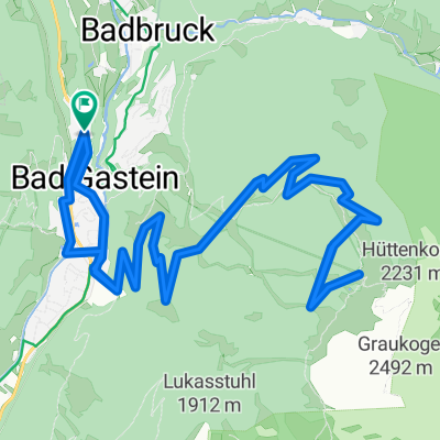 Graukogel Bergstation
- Distance
- 19.9 km
- Ascent
- 1,094 m
- Descent
- 1,095 m
- Location
- Bad Gastein, Salzburg, Austria
 Stage 2 - kralovska etapa
- Distance
- 186 km
- Ascent
- 2,522 m
- Descent
- 3,380 m
- Location
- Bad Gastein, Salzburg, Austria
 Bad Gastein - Möllbrücke
- Distance
- 44.8 km
- Ascent
- 585 m
- Descent
- 1,119 m
- Location
- Bad Gastein, Salzburg, Austria
 Karl-Heinrich-Waggerl-Straße 12, Bad Gastein to Kaiser-Franz-Josef-Straße 41, Bad Gastein
- Distance
- 23 km
- Ascent
- 1,149 m
- Descent
- 1,148 m
- Location
- Bad Gastein, Salzburg, Austria
Open it in the app