
Zaznamenané prostredníctvom inteligentných hodiniek na 31. aug. 2025 na 15:19
A cycling route starting in Gmünd, Lower Austria, Austria.
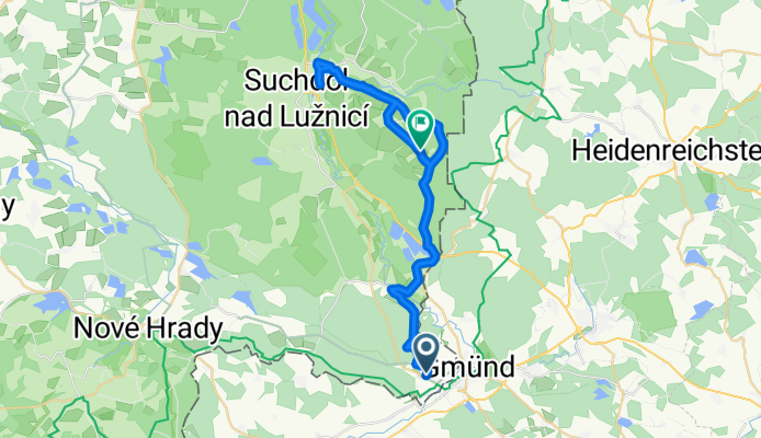
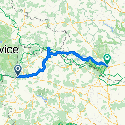
Overview
About this route
- 4 h 7 min
- Duration
- 35.4 km
- Distance
- 197 m
- Ascent
- 230 m
- Descent
- 8.6 km/h
- Avg. speed
- 529 m
- Max. altitude

Route quality
Waytypes & surfaces along the route
Waytypes
Track
15.2 km
(43 %)
Quiet road
11.3 km
(32 %)
Surfaces
Paved
22.6 km
(64 %)
Unpaved
2.5 km
(7 %)
Asphalt
18.8 km
(53 %)
Paved (undefined)
3.9 km
(11 %)
Continue with Bikemap
Use, edit, or download this cycling route
You would like to ride Zaznamenané prostredníctvom inteligentných hodiniek na 31. aug. 2025 na 15:19 or customize it for your own trip? Here is what you can do with this Bikemap route:
Free features
- Save this route as favorite or in collections
- Copy & plan your own version of this route
- Sync your route with Garmin or Wahoo
Premium features
Free trial for 3 days, or one-time payment. More about Bikemap Premium.
- Navigate this route on iOS & Android
- Export a GPX / KML file of this route
- Create your custom printout (try it for free)
- Download this route for offline navigation
Discover more Premium features.
Get Bikemap PremiumFrom our community
Other popular routes starting in Gmünd
 Gmünd nach Litschau
- Distance
- 39.4 km
- Ascent
- 459 m
- Descent
- 426 m
- Location
- Gmünd, Lower Austria, Austria
 Sídliště u Nádraží do Siebenlinden
- Distance
- 15.4 km
- Ascent
- 242 m
- Descent
- 77 m
- Location
- Gmünd, Lower Austria, Austria
 Sídliště u Nádraží do Blockheideweg
- Distance
- 6.3 km
- Ascent
- 64 m
- Descent
- 69 m
- Location
- Gmünd, Lower Austria, Austria
 EV13 Etappe 1: Gmünd - Litschau
- Distance
- 34.4 km
- Ascent
- 408 m
- Descent
- 366 m
- Location
- Gmünd, Lower Austria, Austria
 Ö Runde 2. Etappe
- Distance
- 128.1 km
- Ascent
- 1,521 m
- Descent
- 1,727 m
- Location
- Gmünd, Lower Austria, Austria
 NatUrknallweg
- Distance
- 26.4 km
- Ascent
- 157 m
- Descent
- 154 m
- Location
- Gmünd, Lower Austria, Austria
 Blockheideweg do Weitraer Straße
- Distance
- 4.7 km
- Ascent
- 36 m
- Descent
- 103 m
- Location
- Gmünd, Lower Austria, Austria
 Mandelstein-Sulz-Weitra
- Distance
- 48.2 km
- Ascent
- 566 m
- Descent
- 566 m
- Location
- Gmünd, Lower Austria, Austria
Open it in the app