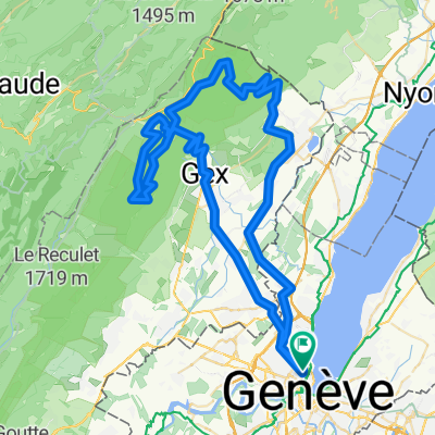
Genève-Calatayud-Hendaye
A cycling route starting in Geneva, Canton of Geneva, Switzerland.
Overview
About this route
Itinéraire empruntant des routes à faible trafic, des voies cyclables et des chemins.
Distance totale effective : 2182 km<br />
Dénivelé positif total : Calcul en cours<br />
Durée : 25 jours (+ repos éventuel)
<span style="text-decoration: underline;">ATTENTION</span> : la route nationale entre La Almunia de Doña Godina et Morata de Jalón (Aragón) est définitivement coupée en raison de la construction d'un barrage ! Faire le détour par Cariñena, le Puerto de Aguarón (1048 m), Codos, Santa Cruz de Grio et la route A2302.
Plus d'informations sur <span style="text-decoration: underline;">www.europebybike.info</span>
- -:--
- Duration
- 2,094.6 km
- Distance
- 5,090 m
- Ascent
- 5,446 m
- Descent
- ---
- Avg. speed
- ---
- Max. altitude
Route quality
Waytypes & surfaces along the route
Waytypes
Road
641.3 km
(31 %)
Busy road
631.1 km
(30 %)
Surfaces
Paved
576.8 km
(28 %)
Unpaved
158.9 km
(8 %)
Asphalt
514.7 km
(25 %)
Gravel
104.7 km
(5 %)
Route highlights
Points of interest along the route
Point of interest after 127 km
Camping "Le Calatrin", Paladru
Point of interest after 216.9 km
Camping "Les îles de Silon", St-Vallier
Point of interest after 276.5 km
Camping de Devesset
Point of interest after 339.1 km
Camping "Audinet", Brives-Charensac
Point of interest after 400.3 km
Camping "La Gravière", Auroux
Point of interest after 485.6 km
Gîtes et camping, Nasbinals
Point of interest after 608.2 km
Camping "Domaine du Surgié", Figeac
Point of interest after 710.2 km
Camping "Les Berges de Caïx", Caïx (Luzech)
Point of interest after 810.8 km
Camping de Gazaille, Castelmoron-sur-Lot
Point of interest after 923 km
Camping "Le Relais Landais", Villeneuve-de-Marsan
Point of interest after 1,033.2 km
Camping du Gave, Sauveterre-de-Béarn
Point of interest after 1,076.9 km
Gîtes et campings, St-Jean-Pied-de-Port
Point of interest after 1,150.5 km
Camping "Osate", Ochagavia
Point of interest after 1,202 km
Camping "Valle de Ansó", Ansó
Point of interest after 1,280.3 km
Camping "Aurin", Sabiñanigo
Point of interest after 1,330.4 km
Camping "La Gorga", Boltaña
Point of interest after 1,446.4 km
Camping, Huesca
Point of interest after 1,528.9 km
Camping Municipal "Ciudad de Zaragoza", Zaragoza
Point of interest after 1,639.1 km
Hostal "La Perla", Calatayud
Point of interest after 1,752.2 km
Camping "Fuente de La Teja", Soria
Point of interest after 1,858.8 km
Camping "La playa", Logroño
Point of interest after 1,945.1 km
Camping, Puente la Reina
Point of interest after 2,031 km
Hostal "Ameztia", Santesteban
Point of interest after 2,090.2 km
Camping "Dorrondeguy", Hendaye
Continue with Bikemap
Use, edit, or download this cycling route
You would like to ride Genève-Calatayud-Hendaye or customize it for your own trip? Here is what you can do with this Bikemap route:
Free features
- Save this route as favorite or in collections
- Copy & plan your own version of this route
- Split it into stages to create a multi-day tour
- Sync your route with Garmin or Wahoo
Premium features
Free trial for 3 days, or one-time payment. More about Bikemap Premium.
- Navigate this route on iOS & Android
- Export a GPX / KML file of this route
- Create your custom printout (try it for free)
- Download this route for offline navigation
Discover more Premium features.
Get Bikemap PremiumFrom our community
Other popular routes starting in Geneva
 25.11 WePerf
- Distance
- 72.5 km
- Ascent
- 380 m
- Descent
- 370 m
- Location
- Geneva, Canton of Geneva, Switzerland
 Bike the Lake - |Lac Leman
- Distance
- 180.7 km
- Ascent
- 271 m
- Descent
- 271 m
- Location
- Geneva, Canton of Geneva, Switzerland
 Backside of the Jura, over Faucille, Marchairuz
- Distance
- 139 km
- Ascent
- 2,635 m
- Descent
- 2,595 m
- Location
- Geneva, Canton of Geneva, Switzerland
 Day 1 Geneva to La Clusaz
- Distance
- 105.8 km
- Ascent
- 2,193 m
- Descent
- 1,533 m
- Location
- Geneva, Canton of Geneva, Switzerland
![29.08 [parcours valloné-roulant]](https://media.bikemap.net/routes/4408925/staticmaps/in_ef9e8f71-6a59-4ff9-a5ee-ab6aa312b752_400x400_bikemap-2021-3D-static.png) 29.08 [parcours valloné-roulant]
29.08 [parcours valloné-roulant]- Distance
- 93.7 km
- Ascent
- 439 m
- Descent
- 440 m
- Location
- Geneva, Canton of Geneva, Switzerland
 Bords du Rhône (Petit Parcours)
- Distance
- 35.6 km
- Ascent
- 417 m
- Descent
- 417 m
- Location
- Geneva, Canton of Geneva, Switzerland
 Pas de l'Echine
- Distance
- 84.8 km
- Ascent
- 1,707 m
- Descent
- 1,705 m
- Location
- Geneva, Canton of Geneva, Switzerland
 Vallée Verte Col Hunting
- Distance
- 92.6 km
- Ascent
- 1,629 m
- Descent
- 1,577 m
- Location
- Geneva, Canton of Geneva, Switzerland
Open it in the app


