
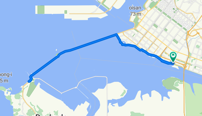
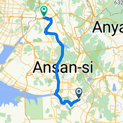
성곡동 839-17 ~ 성곡동 839-17
A cycling route starting in Ansan-si, Gyeonggi-do, South Korea.
Overview
About this route
- 2 h 47 min
- Duration
- 34.8 km
- Distance
- 152 m
- Ascent
- 171 m
- Descent
- 12.5 km/h
- Avg. speed
- 28 m
- Max. altitude
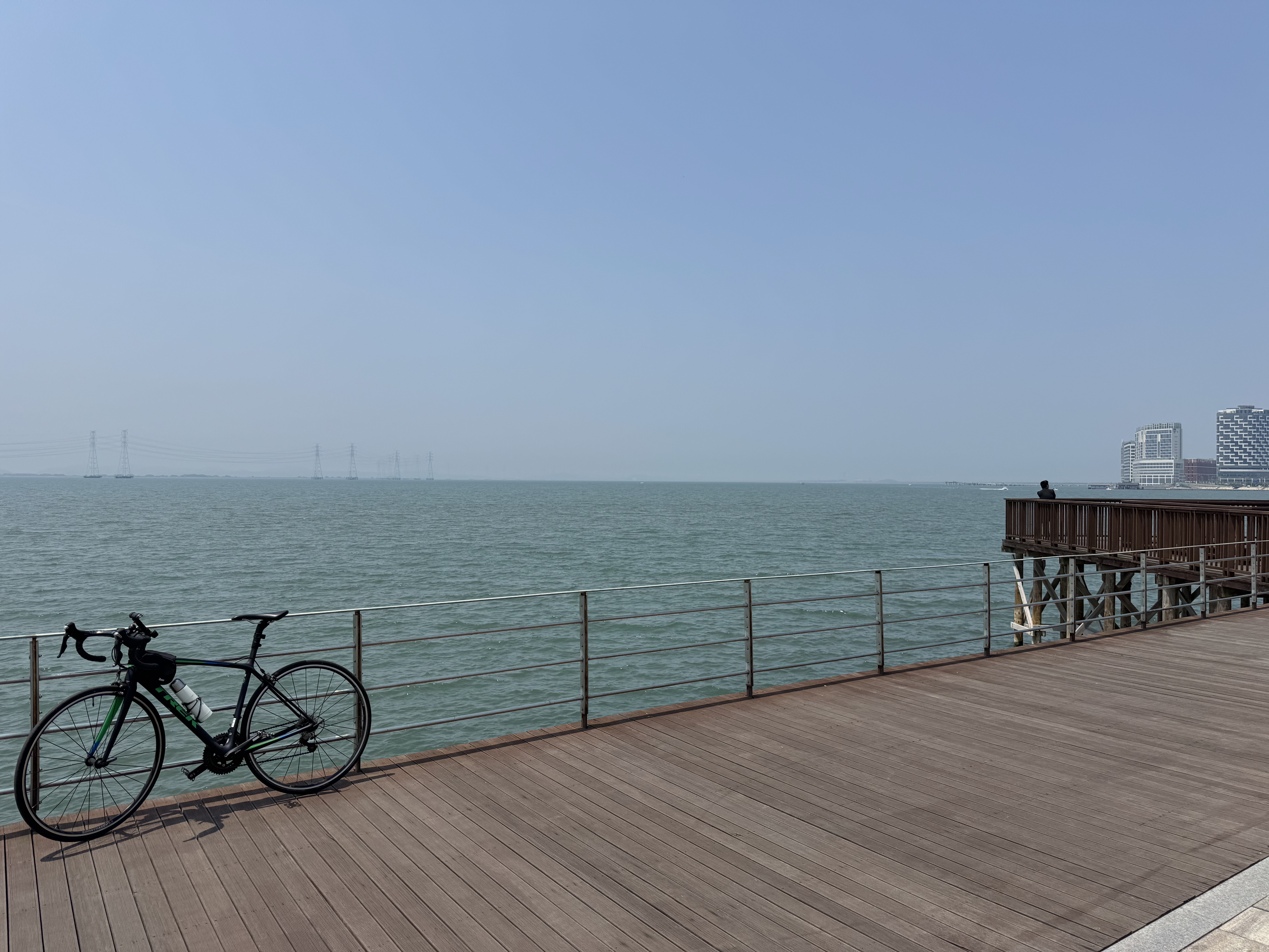
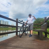
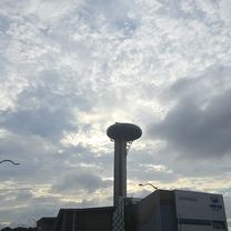
Route photos


Continue with Bikemap
Use, edit, or download this cycling route
You would like to ride 성곡동 839-17 ~ 성곡동 839-17 or customize it for your own trip? Here is what you can do with this Bikemap route:
Free features
- Save this route as favorite or in collections
- Copy & plan your own version of this route
- Sync your route with Garmin or Wahoo
Premium features
Free trial for 3 days, or one-time payment. More about Bikemap Premium.
- Navigate this route on iOS & Android
- Export a GPX / KML file of this route
- Create your custom printout (try it for free)
- Download this route for offline navigation
Discover more Premium features.
Get Bikemap PremiumFrom our community
Other popular routes starting in Ansan-si
 당곡로, 안산시에서 당곡로, 안산시까지
- Distance
- 46.7 km
- Ascent
- 97 m
- Descent
- 95 m
- Location
- Ansan-si, Gyeonggi-do, South Korea
 느린 주행
느린 주행- Distance
- 7.6 km
- Ascent
- 18 m
- Descent
- 42 m
- Location
- Ansan-si, Gyeonggi-do, South Korea
 성곡동 839-17 ~ 성곡동 839-17
- Distance
- 34.8 km
- Ascent
- 152 m
- Descent
- 171 m
- Location
- Ansan-si, Gyeonggi-do, South Korea
 산현동 523-2 ~ 산현동 520-1
- Distance
- 11.2 km
- Ascent
- 50 m
- Descent
- 71 m
- Location
- Ansan-si, Gyeonggi-do, South Korea
 От Wongokbon-dong 945-6, Ansan-si до Seosin-myeon 산2-5, Hwaseong-si
- Distance
- 35.1 km
- Ascent
- 197 m
- Descent
- 212 m
- Location
- Ansan-si, Gyeonggi-do, South Korea
![정왕동 2325-9Ph0]으로 라우팅](https://media.bikemap.net/routes/17331716/gallery/thumbs/6d0f4bee-a84e-46a0-bec3-92be21982f9a.jpg.208x208_q80_crop.jpg) 정왕동 2325-9Ph0]으로 라우팅
정왕동 2325-9Ph0]으로 라우팅- Distance
- 132.7 km
- Ascent
- 711 m
- Descent
- 770 m
- Location
- Ansan-si, Gyeonggi-do, South Korea
 From Suwon to Seoul
- Distance
- 37.7 km
- Ascent
- 285 m
- Descent
- 271 m
- Location
- Ansan-si, Gyeonggi-do, South Korea
 5-12 5-12 ~ 신천동 864-8
- Distance
- 29 km
- Ascent
- 86 m
- Descent
- 74 m
- Location
- Ansan-si, Gyeonggi-do, South Korea
Open it in the app