สันอุ้ม ห้วยเกี๋ยง
A cycling route starting in San Sai, Chiang Mai, Thailand.
Overview
About this route
- 1 h 50 min
- Duration
- 16.6 km
- Distance
- 250 m
- Ascent
- 210 m
- Descent
- 9 km/h
- Avg. speed
- 461 m
- Max. altitude
Route photos
Continue with Bikemap
Use, edit, or download this cycling route
You would like to ride สันอุ้ม ห้วยเกี๋ยง or customize it for your own trip? Here is what you can do with this Bikemap route:
Free features
- Save this route as favorite or in collections
- Copy & plan your own version of this route
- Sync your route with Garmin or Wahoo
Premium features
Free trial for 3 days, or one-time payment. More about Bikemap Premium.
- Navigate this route on iOS & Android
- Export a GPX / KML file of this route
- Create your custom printout (try it for free)
- Download this route for offline navigation
Discover more Premium features.
Get Bikemap PremiumFrom our community
Other popular routes starting in San Sai
ป่าเมี่ยง- Distance
- 46.5 km
- Ascent
- 619 m
- Descent
- 170 m
- Location
- San Sai, Chiang Mai, Thailand
ถนนทีไมมีชือ, Tambon Mae Raem naar ถนนทีไมมีชือ, Tambon Mae Raem- Distance
- 22.8 km
- Ascent
- 427 m
- Descent
- 423 m
- Location
- San Sai, Chiang Mai, Thailand
Supersonic route in Tambon San Sai Noi- Distance
- 32.4 km
- Ascent
- 76 m
- Descent
- 79 m
- Location
- San Sai, Chiang Mai, Thailand
nord Thailand Mars 2011- Distance
- 299.5 km
- Ascent
- 891 m
- Descent
- 837 m
- Location
- San Sai, Chiang Mai, Thailand
ride through Mae Jo- Distance
- 23.2 km
- Ascent
- 62 m
- Descent
- 97 m
- Location
- San Sai, Chiang Mai, Thailand
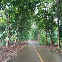
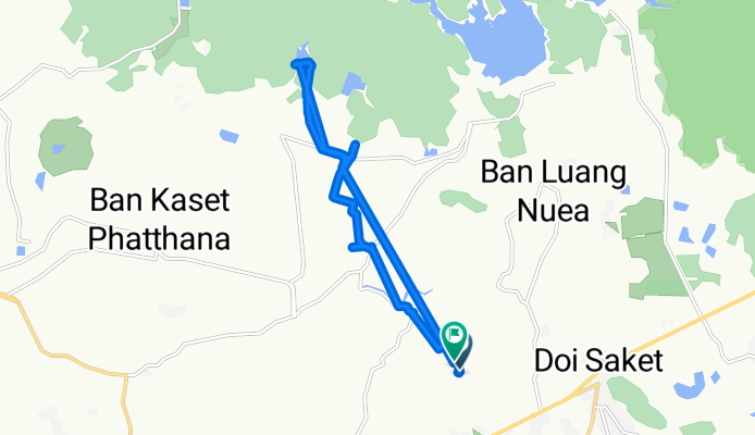
mae rim canal circuit- Distance
- 76.1 km
- Ascent
- 83 m
- Descent
- 78 m
- Location
- San Sai, Chiang Mai, Thailand
maerim to doi saket- Distance
- 44.8 km
- Ascent
- 2,594 m
- Descent
- 2,622 m
- Location
- San Sai, Chiang Mai, Thailand
Pa Phai Sansai to Mae Kuang Dam Loop- Distance
- 55.3 km
- Ascent
- 765 m
- Descent
- 764 m
- Location
- San Sai, Chiang Mai, Thailand
Open it in the app

