

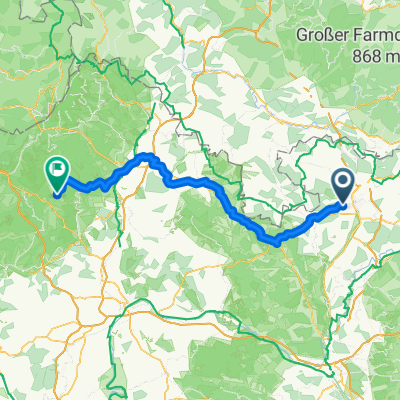
Hof - Staffelstein
A cycling route starting in Ahorn, Bavaria, Germany.
Overview
About this route
- 5 h 52 min
- Duration
- 98.6 km
- Distance
- 797 m
- Ascent
- 841 m
- Descent
- 16.8 km/h
- Avg. speed
- 393 m
- Max. altitude
Route quality
Waytypes & surfaces along the route
Waytypes
Path
30.6 km
(31 %)
Quiet road
26.6 km
(27 %)
Surfaces
Paved
82.8 km
(84 %)
Unpaved
3.9 km
(4 %)
Asphalt
79.8 km
(81 %)
Gravel
3.9 km
(4 %)
Continue with Bikemap
Use, edit, or download this cycling route
You would like to ride Hof - Staffelstein or customize it for your own trip? Here is what you can do with this Bikemap route:
Free features
- Save this route as favorite or in collections
- Copy & plan your own version of this route
- Split it into stages to create a multi-day tour
- Sync your route with Garmin or Wahoo
Premium features
Free trial for 3 days, or one-time payment. More about Bikemap Premium.
- Navigate this route on iOS & Android
- Export a GPX / KML file of this route
- Create your custom printout (try it for free)
- Download this route for offline navigation
Discover more Premium features.
Get Bikemap PremiumFrom our community
Other popular routes starting in Ahorn
 Verborgene Schlössertour
- Distance
- 37.9 km
- Ascent
- 459 m
- Descent
- 460 m
- Location
- Ahorn, Bavaria, Germany
 Verborgene Schlösser im südlichen Landkreis CLONED FROM ROUTE 184760
- Distance
- 37.9 km
- Ascent
- 466 m
- Descent
- 467 m
- Location
- Ahorn, Bavaria, Germany
 Ahorn - Froschgrundsee
- Distance
- 38.2 km
- Ascent
- 264 m
- Descent
- 264 m
- Location
- Ahorn, Bavaria, Germany
 Hof - Staffelstein
- Distance
- 98.6 km
- Ascent
- 797 m
- Descent
- 841 m
- Location
- Ahorn, Bavaria, Germany
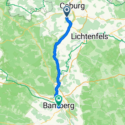 Hohenstein, Ahorn nach Obere Mühlbrücke, Bamberg
- Distance
- 46.7 km
- Ascent
- 116 m
- Descent
- 259 m
- Location
- Ahorn, Bavaria, Germany
 Verborgene Schlösser im südlichen Landkreis
- Distance
- 37.8 km
- Ascent
- 602 m
- Descent
- 629 m
- Location
- Ahorn, Bavaria, Germany
 Rundtour Ahorn Zeilberg
- Distance
- 50.5 km
- Ascent
- 532 m
- Descent
- 533 m
- Location
- Ahorn, Bavaria, Germany
 CBG - Altenstein - Lichtenstein - Gereuth - Cbg
- Distance
- 59.9 km
- Ascent
- 703 m
- Descent
- 764 m
- Location
- Ahorn, Bavaria, Germany
Open it in the app