
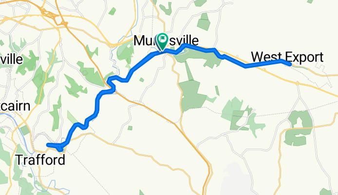
Westmoreland Heritage Trail, Murrysville to Westmoreland Heritage Trail, Murrysville
A cycling route starting in Murrysville, Pennsylvania, United States.
Overview
About this route
Franklin township municipal
- 1 h 38 min
- Duration
- 28.8 km
- Distance
- 129 m
- Ascent
- 124 m
- Descent
- 17.6 km/h
- Avg. speed
- 298 m
- Max. altitude

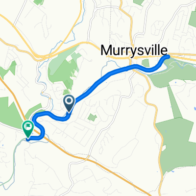
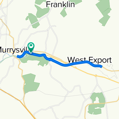
Route photos


Route quality
Waytypes & surfaces along the route
Waytypes
Cycleway
27.1 km
(94 %)
Pedestrian area
0.8 km
(3 %)
Surfaces
Paved
1.7 km
(6 %)
Unpaved
19.3 km
(67 %)
Loose gravel
18.7 km
(65 %)
Paved (undefined)
1.5 km
(5 %)
Continue with Bikemap
Use, edit, or download this cycling route
You would like to ride Westmoreland Heritage Trail, Murrysville to Westmoreland Heritage Trail, Murrysville or customize it for your own trip? Here is what you can do with this Bikemap route:
Free features
- Save this route as favorite or in collections
- Copy & plan your own version of this route
- Sync your route with Garmin or Wahoo
Premium features
Free trial for 3 days, or one-time payment. More about Bikemap Premium.
- Navigate this route on iOS & Android
- Export a GPX / KML file of this route
- Create your custom printout (try it for free)
- Download this route for offline navigation
Discover more Premium features.
Get Bikemap PremiumFrom our community
Other popular routes starting in Murrysville
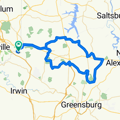
 Apollo Avonmore loop
- Distance
- 64.3 km
- Ascent
- 744 m
- Descent
- 744 m
- Location
- Murrysville, Pennsylvania, United States
 Dolomite Drive 107, Monroeville to Bel Aire Drive 127, Monroeville
- Distance
- 8.2 km
- Ascent
- 45 m
- Descent
- 53 m
- Location
- Murrysville, Pennsylvania, United States
 4351 William Penn Hwy, Murrysville to 4285 William Penn Hwy, Murrysville
- Distance
- 5.2 km
- Ascent
- 57 m
- Descent
- 53 m
- Location
- Murrysville, Pennsylvania, United States
 Colonial Place 3305, Murrysville to Colonial Place 3305, Murrysville
- Distance
- 3.7 km
- Ascent
- 52 m
- Descent
- 51 m
- Location
- Murrysville, Pennsylvania, United States
 Restful route in Murrysville
- Distance
- 9.3 km
- Ascent
- 93 m
- Descent
- 87 m
- Location
- Murrysville, Pennsylvania, United States
 William Penn Highway 4285, Murrysville to William Penn Highway 4349, Murrysville
- Distance
- 13 km
- Ascent
- 53 m
- Descent
- 19 m
- Location
- Murrysville, Pennsylvania, United States
 tour #2
- Distance
- 51.1 km
- Ascent
- 479 m
- Descent
- 454 m
- Location
- Murrysville, Pennsylvania, United States
 65k
65k- Distance
- 65 km
- Ascent
- 470 m
- Descent
- 469 m
- Location
- Murrysville, Pennsylvania, United States
Open it in the app