

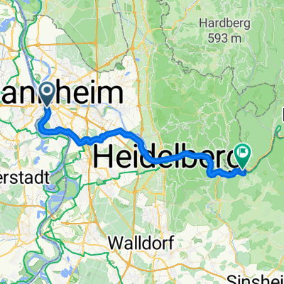
MA - Speyer
A cycling route starting in Ludwigshafen am Rhein, Rhineland-Palatinate, Germany.
Overview
About this route
- -:--
- Duration
- 55.5 km
- Distance
- 71 m
- Ascent
- 71 m
- Descent
- ---
- Avg. speed
- ---
- Max. altitude
Route quality
Waytypes & surfaces along the route
Waytypes
Path
12.8 km
(23 %)
Track
12.2 km
(22 %)
Surfaces
Paved
49.4 km
(89 %)
Asphalt
48.3 km
(87 %)
Paved (undefined)
0.6 km
(1 %)
Continue with Bikemap
Use, edit, or download this cycling route
You would like to ride MA - Speyer or customize it for your own trip? Here is what you can do with this Bikemap route:
Free features
- Save this route as favorite or in collections
- Copy & plan your own version of this route
- Sync your route with Garmin or Wahoo
Premium features
Free trial for 3 days, or one-time payment. More about Bikemap Premium.
- Navigate this route on iOS & Android
- Export a GPX / KML file of this route
- Create your custom printout (try it for free)
- Download this route for offline navigation
Discover more Premium features.
Get Bikemap PremiumFrom our community
Other popular routes starting in Ludwigshafen am Rhein
 LU-Kalmit-LU
- Distance
- 97.5 km
- Ascent
- 688 m
- Descent
- 694 m
- Location
- Ludwigshafen am Rhein, Rhineland-Palatinate, Germany
 Vorderpfalztour
- Distance
- 61.5 km
- Ascent
- 177 m
- Descent
- 179 m
- Location
- Ludwigshafen am Rhein, Rhineland-Palatinate, Germany
 nixda
nixda- Distance
- 5.3 km
- Ascent
- 0 m
- Descent
- 4 m
- Location
- Ludwigshafen am Rhein, Rhineland-Palatinate, Germany
 ¿?· ? nach ¿?· ?
- Distance
- 23.1 km
- Ascent
- 39 m
- Descent
- 49 m
- Location
- Ludwigshafen am Rhein, Rhineland-Palatinate, Germany
 BASF Radtour 2011
- Distance
- 159.1 km
- Ascent
- 667 m
- Descent
- 668 m
- Location
- Ludwigshafen am Rhein, Rhineland-Palatinate, Germany
 MA - Speyer
- Distance
- 55.5 km
- Ascent
- 71 m
- Descent
- 71 m
- Location
- Ludwigshafen am Rhein, Rhineland-Palatinate, Germany
 ADFC Mannheim So,12.07.2009
- Distance
- 87.7 km
- Ascent
- 326 m
- Descent
- 323 m
- Location
- Ludwigshafen am Rhein, Rhineland-Palatinate, Germany
 3 Mannheim Rheinau Dilsberg
- Distance
- 42 km
- Ascent
- 479 m
- Descent
- 315 m
- Location
- Ludwigshafen am Rhein, Rhineland-Palatinate, Germany
Open it in the app