
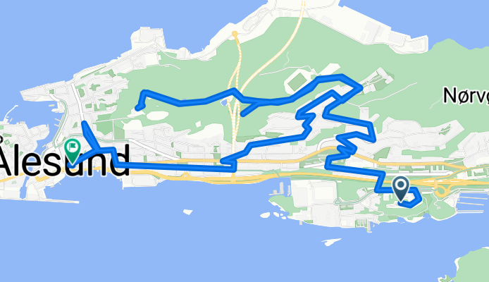
Sjømannsvegen, Ålesund nach Keiser Wilhelm-gata, Ålesund
A cycling route starting in Ålesund, Møre og Romsdal, Norway.
Overview
About this route
- 27 min
- Duration
- 8.9 km
- Distance
- 227 m
- Ascent
- 245 m
- Descent
- 19.6 km/h
- Avg. speed
- 161 m
- Max. altitude

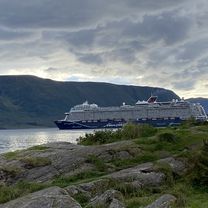
Route photos


Route quality
Waytypes & surfaces along the route
Waytypes
Quiet road
5.7 km
(64 %)
Road
1.9 km
(21 %)
Surfaces
Paved
6.8 km
(77 %)
Unpaved
0.3 km
(3 %)
Asphalt
6.7 km
(76 %)
Gravel
0.3 km
(3 %)
Continue with Bikemap
Use, edit, or download this cycling route
You would like to ride Sjømannsvegen, Ålesund nach Keiser Wilhelm-gata, Ålesund or customize it for your own trip? Here is what you can do with this Bikemap route:
Free features
- Save this route as favorite or in collections
- Copy & plan your own version of this route
- Sync your route with Garmin or Wahoo
Premium features
Free trial for 3 days, or one-time payment. More about Bikemap Premium.
- Navigate this route on iOS & Android
- Export a GPX / KML file of this route
- Create your custom printout (try it for free)
- Download this route for offline navigation
Discover more Premium features.
Get Bikemap PremiumFrom our community
Other popular routes starting in Ålesund
 Fagerlia - Magerholm - Valle - Olsvika - Lerstad - Fagerlia
- Distance
- 58 km
- Ascent
- 458 m
- Descent
- 454 m
- Location
- Ålesund, Møre og Romsdal, Norway
 Keiser Wilhelm-gata, Ålesund nach Volsdalsberga, Ålesund
- Distance
- 2.8 km
- Ascent
- 81 m
- Descent
- 61 m
- Location
- Ålesund, Møre og Romsdal, Norway
 Ellingsøya-Engesetdalen-Skodje-Brusdal-Fagerlia
- Distance
- 66.1 km
- Ascent
- 496 m
- Descent
- 448 m
- Location
- Ålesund, Møre og Romsdal, Norway
 Fagerlia - Mørkeset - Skodje - Engesetdal - Fagerlia
- Distance
- 74.8 km
- Ascent
- 612 m
- Descent
- 614 m
- Location
- Ålesund, Møre og Romsdal, Norway
 Giskegata, Ålesund nach Keiser Wilhelm-gata, Ålesund
- Distance
- 27.2 km
- Ascent
- 456 m
- Descent
- 484 m
- Location
- Ålesund, Møre og Romsdal, Norway
 centrum Alesund - wzgórze Aksla
- Distance
- 1.5 km
- Ascent
- 110 m
- Descent
- 42 m
- Location
- Ålesund, Møre og Romsdal, Norway
 Kongens gate - Borgernes veg - Larsgården - Klipra - Fjellstua - Fagerlia
- Distance
- 15.5 km
- Ascent
- 402 m
- Descent
- 360 m
- Location
- Ålesund, Møre og Romsdal, Norway
 Ringgata, Ålesund - Nordhaugsvegen, Trondheim
- Distance
- 398 km
- Ascent
- 5,117 m
- Descent
- 5,070 m
- Location
- Ålesund, Møre og Romsdal, Norway
Open it in the app