
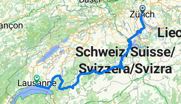
Lakes Route - Zurich to Lausanne
A cycling route starting in Zürich (Kreis 6) / Oberstrass, Canton of Zurich, Switzerland.
Overview
About this route
More about the Lakes Route:
https://www.cyclingthread.com/exploring-swiss-alps-cycling-lakes-route-in-switzerland
The Lakes Route is a 500-kilometer cycling route across postcard-like Switzerland, linking ten scenic lakes and regions such as Werdenberg, Lucerne at the foot of Mount Pilatus, Iseltwald on Lake Brienz, Gruyères, and the Lavaux vineyards above Lake Geneva. The version described starts in Zurich and finishes in Lausanne, passing through Zug, Lucerne, Meiringen, Interlaken, Spiez, and Gstaad. According to Switzerland Mobility, the route is about 510 km long with a total elevation gain of roughly 5900 m. It offers outstanding views of Alpine lakes, charming towns, and valleys, making it perfect for a multi-day journey. Many riders plan 6 to 8 days to complete the route, depending on pace and stops. Its demanding profile with climbs and descents makes it both challenging and rewarding. In the end, the Lakes Route is a well-organized and scenic cycling adventure that captures the variety of Swiss landscapes.
- 23 h 31 min
- Duration
- 341.3 km
- Distance
- 5,957 m
- Ascent
- 5,992 m
- Descent
- 14.5 km/h
- Avg. speed
- 1,285 m
- Max. altitude

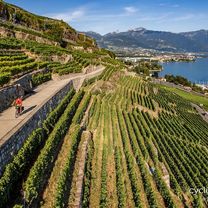
Route photos


Continue with Bikemap
Use, edit, or download this cycling route
You would like to ride Lakes Route - Zurich to Lausanne or customize it for your own trip? Here is what you can do with this Bikemap route:
Free features
- Save this route as favorite or in collections
- Copy & plan your own version of this route
- Split it into stages to create a multi-day tour
- Sync your route with Garmin or Wahoo
Premium features
Free trial for 3 days, or one-time payment. More about Bikemap Premium.
- Navigate this route on iOS & Android
- Export a GPX / KML file of this route
- Create your custom printout (try it for free)
- Download this route for offline navigation
Discover more Premium features.
Get Bikemap PremiumFrom our community
Other popular routes starting in Zürich (Kreis 6) / Oberstrass
 ASVZ-Runde Mont Sonnenbüel
- Distance
- 63.6 km
- Ascent
- 696 m
- Descent
- 753 m
- Location
- Zürich (Kreis 6) / Oberstrass, Canton of Zurich, Switzerland
 Giro ASVZ
- Distance
- 88.8 km
- Ascent
- 1,263 m
- Descent
- 1,331 m
- Location
- Zürich (Kreis 6) / Oberstrass, Canton of Zurich, Switzerland
 Ausfahrt durch Zürich
- Distance
- 15.6 km
- Ascent
- 283 m
- Descent
- 311 m
- Location
- Zürich (Kreis 6) / Oberstrass, Canton of Zurich, Switzerland
 Zurich - big loop
- Distance
- 138.7 km
- Ascent
- 1,694 m
- Descent
- 1,694 m
- Location
- Zürich (Kreis 6) / Oberstrass, Canton of Zurich, Switzerland
 Day 1 - Zurich to Walenstadt
- Distance
- 85.9 km
- Ascent
- 194 m
- Descent
- 226 m
- Location
- Zürich (Kreis 6) / Oberstrass, Canton of Zurich, Switzerland
 ASVZ Donnerstagsrunde
- Distance
- 45.9 km
- Ascent
- 455 m
- Descent
- 526 m
- Location
- Zürich (Kreis 6) / Oberstrass, Canton of Zurich, Switzerland
 ASVZ Donnerstags Sommerrunde Züri Oberland
- Distance
- 58.6 km
- Ascent
- 837 m
- Descent
- 900 m
- Location
- Zürich (Kreis 6) / Oberstrass, Canton of Zurich, Switzerland
 Lakes Route - Zurich to Lausanne
- Distance
- 341.3 km
- Ascent
- 5,957 m
- Descent
- 5,992 m
- Location
- Zürich (Kreis 6) / Oberstrass, Canton of Zurich, Switzerland
Open it in the app