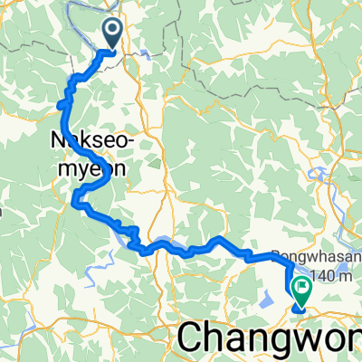
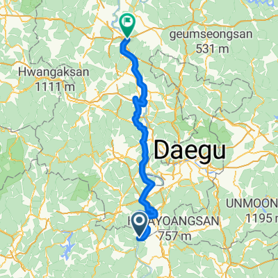
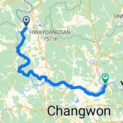
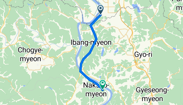
Daehap - Changnyeong
A cycling route starting in Daehap, Gyeongsangnam-do, South Korea.
Overview
About this route
- 1 h 15 min
- Duration
- 18.7 km
- Distance
- 266 m
- Ascent
- 215 m
- Descent
- 15 km/h
- Avg. speed
- 64 m
- Max. altitude
Route quality
Waytypes & surfaces along the route
Waytypes
Road
6.7 km
(36 %)
Cycleway
4.7 km
(25 %)
Surfaces
Paved
11.4 km
(61 %)
Asphalt
9 km
(48 %)
Concrete
2.4 km
(13 %)
Undefined
7.3 km
(39 %)
Continue with Bikemap
Use, edit, or download this cycling route
You would like to ride Daehap - Changnyeong or customize it for your own trip? Here is what you can do with this Bikemap route:
Free features
- Save this route as favorite or in collections
- Copy & plan your own version of this route
- Sync your route with Garmin or Wahoo
Premium features
Free trial for 3 days, or one-time payment. More about Bikemap Premium.
- Navigate this route on iOS & Android
- Export a GPX / KML file of this route
- Create your custom printout (try it for free)
- Download this route for offline navigation
Discover more Premium features.
Get Bikemap PremiumFrom our community
Other popular routes starting in Daehap
Day8_Hyeonpungmyeon_Daesanmyeon- Distance
- 96.6 km
- Ascent
- 432 m
- Descent
- 431 m
- Location
- Daehap, Gyeongsangnam-do, South Korea
141, Dalseong2chadong 1-ro, Daegu naar Nakdonggang-ro,- Distance
- 89.5 km
- Ascent
- 670 m
- Descent
- 528 m
- Location
- Daehap, Gyeongsangnam-do, South Korea
? 과학마을로3길 - Busan- Distance
- 103.9 km
- Ascent
- 543 m
- Descent
- 553 m
- Location
- Daehap, Gyeongsangnam-do, South Korea
Daehap - Changnyeong- Distance
- 18.7 km
- Ascent
- 266 m
- Descent
- 215 m
- Location
- Daehap, Gyeongsangnam-do, South Korea
seoul - busan j6- Distance
- 84.7 km
- Ascent
- 718 m
- Descent
- 744 m
- Location
- Daehap, Gyeongsangnam-do, South Korea
Route to Samnangjin-eup 510-6, Miryang-si- Distance
- 110.5 km
- Ascent
- 657 m
- Descent
- 739 m
- Location
- Daehap, Gyeongsangnam-do, South Korea
Guji-myeon 849-8 to Hyeonpung-myeon 1116- Distance
- 3.8 km
- Ascent
- 50 m
- Descent
- 34 m
- Location
- Daehap, Gyeongsangnam-do, South Korea
Ph0]에서 경로초계면 28-2, 합천군- Distance
- 67.3 km
- Ascent
- 755 m
- Descent
- 756 m
- Location
- Daehap, Gyeongsangnam-do, South Korea
Open it in the app


