
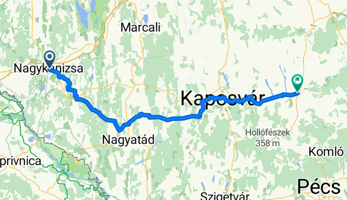
From Nagykanizsa to Dombóvár
A cycling route starting in Nagykanizsa, Zala County, Hungary.
Overview
About this route
- 7 h 47 min
- Duration
- 121.5 km
- Distance
- 649 m
- Ascent
- 680 m
- Descent
- 15.6 km/h
- Avg. speed
- 227 m
- Max. altitude

Route quality
Waytypes & surfaces along the route
Waytypes
Quiet road
40.1 km
(33 %)
Track
30.4 km
(25 %)
Surfaces
Paved
42.5 km
(35 %)
Unpaved
4.9 km
(4 %)
Asphalt
36.4 km
(30 %)
Concrete
3.6 km
(3 %)
Continue with Bikemap
Use, edit, or download this cycling route
You would like to ride From Nagykanizsa to Dombóvár or customize it for your own trip? Here is what you can do with this Bikemap route:
Free features
- Save this route as favorite or in collections
- Copy & plan your own version of this route
- Split it into stages to create a multi-day tour
- Sync your route with Garmin or Wahoo
Premium features
Free trial for 3 days, or one-time payment. More about Bikemap Premium.
- Navigate this route on iOS & Android
- Export a GPX / KML file of this route
- Create your custom printout (try it for free)
- Download this route for offline navigation
Discover more Premium features.
Get Bikemap PremiumFrom our community
Other popular routes starting in Nagykanizsa
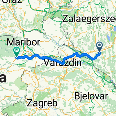 Vasút utca, Nagykanizsa - Zgornja Ložnica, Zgornja Ložnica
- Distance
- 153.3 km
- Ascent
- 505 m
- Descent
- 367 m
- Location
- Nagykanizsa, Zala County, Hungary
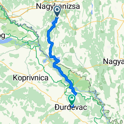 Nagykanizsa - Kalinovac
- Distance
- 58 km
- Ascent
- 171 m
- Descent
- 217 m
- Location
- Nagykanizsa, Zala County, Hungary
 Mórichelyi kör
- Distance
- 31 km
- Ascent
- 402 m
- Descent
- 402 m
- Location
- Nagykanizsa, Zala County, Hungary
 Bartók Béla utca, Nagykanizsa - Bartók Béla utca, Nagykanizsa
- Distance
- 53.1 km
- Ascent
- 288 m
- Descent
- 288 m
- Location
- Nagykanizsa, Zala County, Hungary
 Tengerre magyar 1.st day
- Distance
- 174.9 km
- Ascent
- 410 m
- Descent
- 437 m
- Location
- Nagykanizsa, Zala County, Hungary
 From Nagykanizsa to Dombóvár
- Distance
- 121.5 km
- Ascent
- 649 m
- Descent
- 680 m
- Location
- Nagykanizsa, Zala County, Hungary
 MURA_Kanizsa_50
- Distance
- 49.6 km
- Ascent
- 178 m
- Descent
- 178 m
- Location
- Nagykanizsa, Zala County, Hungary
 Börzönce1
- Distance
- 65.4 km
- Ascent
- 327 m
- Descent
- 327 m
- Location
- Nagykanizsa, Zala County, Hungary
Open it in the app