
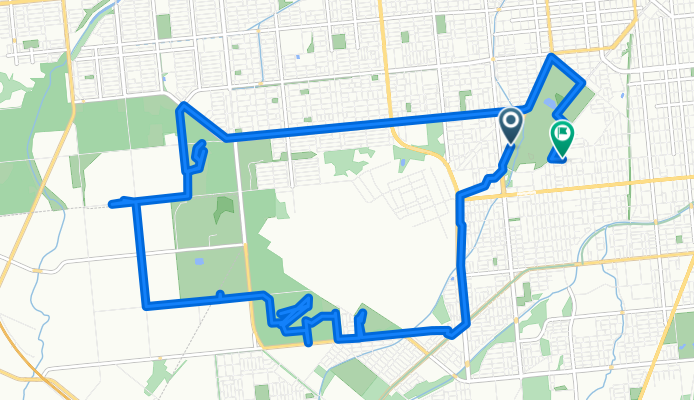
緑ケ丘, 帯広市へ西11条南27丁目, 帯広市
A cycling route starting in Obihiro, Hokkaido, Japan.
Overview
About this route
- 2 h 23 min
- Duration
- 20.2 km
- Distance
- 309 m
- Ascent
- 313 m
- Descent
- 8.5 km/h
- Avg. speed
- 100 m
- Max. altitude

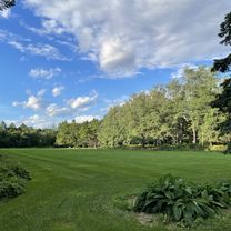
Route photos


Continue with Bikemap
Use, edit, or download this cycling route
You would like to ride 緑ケ丘, 帯広市へ西11条南27丁目, 帯広市 or customize it for your own trip? Here is what you can do with this Bikemap route:
Free features
- Save this route as favorite or in collections
- Copy & plan your own version of this route
- Sync your route with Garmin or Wahoo
Premium features
Free trial for 3 days, or one-time payment. More about Bikemap Premium.
- Navigate this route on iOS & Android
- Export a GPX / KML file of this route
- Create your custom printout (try it for free)
- Download this route for offline navigation
Discover more Premium features.
Get Bikemap PremiumFrom our community
Other popular routes starting in Obihiro
 帶廣到然別湖
- Distance
- 64.6 km
- Ascent
- 904 m
- Descent
- 131 m
- Location
- Obihiro, Hokkaido, Japan
 トカプチ400
- Distance
- 402.9 km
- Ascent
- 3,221 m
- Descent
- 3,223 m
- Location
- Obihiro, Hokkaido, Japan
 緑ケ丘, 帯広市へ西11条南27丁目, 帯広市
- Distance
- 20.2 km
- Ascent
- 309 m
- Descent
- 313 m
- Location
- Obihiro, Hokkaido, Japan
 hokkaido20100813
- Distance
- 281.6 km
- Ascent
- 1,402 m
- Descent
- 1,434 m
- Location
- Obihiro, Hokkaido, Japan
 十勝南部名勝巡禮
- Distance
- 71.7 km
- Ascent
- 250 m
- Descent
- 247 m
- Location
- Obihiro, Hokkaido, Japan
 0926帶廣市-トマム84km
- Distance
- 109.2 km
- Ascent
- 1,164 m
- Descent
- 662 m
- Location
- Obihiro, Hokkaido, Japan
 北海道DAY5
- Distance
- 130.3 km
- Ascent
- 244 m
- Descent
- 283 m
- Location
- Obihiro, Hokkaido, Japan
 夏 帯広 三国峠 美瑛
- Distance
- 411 km
- Ascent
- 1,832 m
- Descent
- 1,850 m
- Location
- Obihiro, Hokkaido, Japan
Open it in the app