

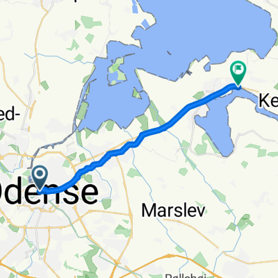
Odense, Odense C à Snekkeled, Munkebo
A cycling route starting in Odense, Region South Denmark, Denmark.
Overview
About this route
- 55 min
- Duration
- 15.9 km
- Distance
- 19 m
- Ascent
- 26 m
- Descent
- 17.4 km/h
- Avg. speed
- 15 m
- Max. altitude
Route quality
Waytypes & surfaces along the route
Waytypes
Cycleway
11.9 km
(75 %)
Road
1.6 km
(10 %)
Surfaces
Paved
15.3 km
(96 %)
Asphalt
15.1 km
(95 %)
Concrete
0.2 km
(1 %)
Undefined
0.6 km
(4 %)
Continue with Bikemap
Use, edit, or download this cycling route
You would like to ride Odense, Odense C à Snekkeled, Munkebo or customize it for your own trip? Here is what you can do with this Bikemap route:
Free features
- Save this route as favorite or in collections
- Copy & plan your own version of this route
- Sync your route with Garmin or Wahoo
Premium features
Free trial for 3 days, or one-time payment. More about Bikemap Premium.
- Navigate this route on iOS & Android
- Export a GPX / KML file of this route
- Create your custom printout (try it for free)
- Download this route for offline navigation
Discover more Premium features.
Get Bikemap PremiumFrom our community
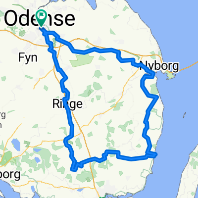
Other popular routes starting in Odense
 Odense-Davinde
- Distance
- 38.6 km
- Ascent
- 82 m
- Descent
- 82 m
- Location
- Odense, Region South Denmark, Denmark
 Klippesalen 12, Odense SV to Klippesalen 12, Odense SV
- Distance
- 30.7 km
- Ascent
- 981 m
- Descent
- 984 m
- Location
- Odense, Region South Denmark, Denmark
 Odense, Odense C à Snekkeled, Munkebo
- Distance
- 15.9 km
- Ascent
- 19 m
- Descent
- 26 m
- Location
- Odense, Region South Denmark, Denmark
 Brændekilde-Hesbjerg Skov
- Distance
- 31.3 km
- Ascent
- 124 m
- Descent
- 122 m
- Location
- Odense, Region South Denmark, Denmark
 Lindeallé, Odense M to Lindeallé, Odense M
- Distance
- 122.9 km
- Ascent
- 495 m
- Descent
- 496 m
- Location
- Odense, Region South Denmark, Denmark
 18 July 2020 - tandem
- Distance
- 36.1 km
- Ascent
- 74 m
- Descent
- 74 m
- Location
- Odense, Region South Denmark, Denmark
 2025-07-04 Nördlich von Odense
- Distance
- 69.7 km
- Ascent
- 70 m
- Descent
- 70 m
- Location
- Odense, Region South Denmark, Denmark
 ALOC kort mandagsrute - Vest
- Distance
- 45 km
- Ascent
- 220 m
- Descent
- 222 m
- Location
- Odense, Region South Denmark, Denmark
Open it in the app