
COL DE MANTET (por Vilafranca de Conflent)
A cycling route starting in Vernet-les-Bains, Occitanie, France.
Overview
About this route
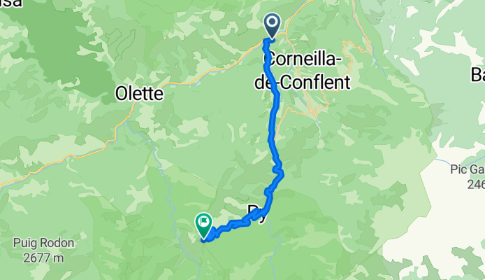
The Col de Mantet is one of the great hidden climbs of the French Eastern Pyrenees, located in the Roussillon region within the Canigó massif. Its ascent starts near Prades in the Têt valley and stretches for more than 21 kilometres to reach the small, isolated village of Mantet at 1734 metres above sea level. The climb combines a friendly, rideable opening with an extremely hard final section, making it one of the most demanding and little-known ascents in the Pyrenean chain.
- 1 h 38 min
- Duration
- 21.4 km
- Distance
- 1,759 m
- Ascent
- 460 m
- Descent
- 13.1 km/h
- Avg. speed
- 1,771 m
- Max. altitude

Route photos
\"")
Route quality
Waytypes & surfaces along the route
Waytypes
Road
14.6 km
(68 %)
Undefined
6.9 km
(32 %)
Surfaces
Paved
1.9 km
(9 %)
Asphalt
1.9 km
(9 %)
Undefined
19.5 km
(91 %)
Continue with Bikemap
Use, edit, or download this cycling route
You would like to ride COL DE MANTET (por Vilafranca de Conflent) or customize it for your own trip? Here is what you can do with this Bikemap route:
Free features
- Save this route as favorite or in collections
- Copy & plan your own version of this route
- Sync your route with Garmin or Wahoo
Premium features
Free trial for 3 days, or one-time payment. More about Bikemap Premium.
- Navigate this route on iOS & Android
- Export a GPX / KML file of this route
- Create your custom printout (try it for free)
- Download this route for offline navigation
Discover more Premium features.
Get Bikemap PremiumFrom our community
Other popular routes starting in Vernet-les-Bains
 canigó2
- Distance
- 16.6 km
- Ascent
- 184 m
- Descent
- 2,010 m
- Location
- Vernet-les-Bains, Occitanie, France
 Stage 4 - Tour de Lads
- Distance
- 177.3 km
- Ascent
- 982 m
- Descent
- 1,616 m
- Location
- Vernet-les-Bains, Occitanie, France
 20180626 Camí de Menut
- Distance
- 3.9 km
- Ascent
- 2,796 m
- Descent
- 2,793 m
- Location
- Vernet-les-Bains, Occitanie, France
 VTTistes pas touristes 2016 2/4
- Distance
- 32.9 km
- Ascent
- 1,844 m
- Descent
- 1,595 m
- Location
- Vernet-les-Bains, Occitanie, France
 Vernet_Circuit_12_amélioré
- Distance
- 31.9 km
- Ascent
- 1,569 m
- Descent
- 1,596 m
- Location
- Vernet-les-Bains, Occitanie, France
 6 Mas Dels Plans, Ayguatébia-Talau à 6 Mas Dels Plans, Ayguatébia-Talau
- Distance
- 5.3 km
- Ascent
- 145 m
- Descent
- 132 m
- Location
- Vernet-les-Bains, Occitanie, France
 vernet les bains_sirach_retour rte
- Distance
- 31 km
- Ascent
- 815 m
- Descent
- 815 m
- Location
- Vernet-les-Bains, Occitanie, France
 Col de Mantet on a Brompton.
- Distance
- 14.3 km
- Ascent
- 1,119 m
- Descent
- 51 m
- Location
- Vernet-les-Bains, Occitanie, France
Open it in the app