
ㅇㅇㅇㅇ어엉ㅇ
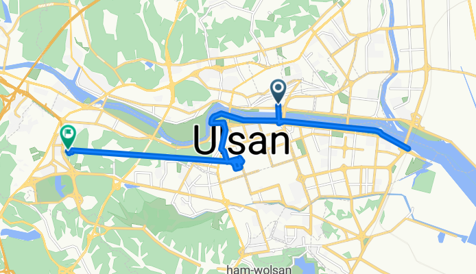
A cycling route starting in Ulsan, Ulsan, South Korea.
Overview
About this route
- 13 h 20 min
- Duration
- 21.1 km
- Distance
- 279 m
- Ascent
- 252 m
- Descent
- 1.6 km/h
- Avg. speed
- 89 m
- Max. altitude

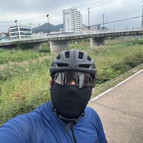
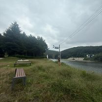
Route photos


Continue with Bikemap
Use, edit, or download this cycling route
You would like to ride ㅇㅇㅇㅇ어엉ㅇ or customize it for your own trip? Here is what you can do with this Bikemap route:
Free features
- Save this route as favorite or in collections
- Copy & plan your own version of this route
- Sync your route with Garmin or Wahoo
Premium features
Free trial for 3 days, or one-time payment. More about Bikemap Premium.
- Navigate this route on iOS & Android
- Export a GPX / KML file of this route
- Create your custom printout (try it for free)
- Download this route for offline navigation
Discover more Premium features.
Get Bikemap PremiumFrom our community
Other popular routes starting in Ulsan
 신정동, 울산광역시에서 신정동, 울산광역시까지
- Distance
- 50.2 km
- Ascent
- 303 m
- Descent
- 321 m
- Location
- Ulsan, Ulsan, South Korea
 상안동, 울산광역시에서 호계로, 울산광역시까지
- Distance
- 45.4 km
- Ascent
- 384 m
- Descent
- 383 m
- Location
- Ulsan, Ulsan, South Korea
 신천동, 울산광역시에서 창평동, 울산광역시까지
- Distance
- 12.1 km
- Ascent
- 80 m
- Descent
- 75 m
- Location
- Ulsan, Ulsan, South Korea
 송정동, 울산광역시에서 두동로, 울산광역시까지
- Distance
- 23.4 km
- Ascent
- 51 m
- Descent
- 78 m
- Location
- Ulsan, Ulsan, South Korea
![Ph0]에서 경로달동 1355-10](https://media.bikemap.net/routes/17536503/gallery/thumbs/55e44673-ec29-4149-828c-68bb36b06268.jpg.208x208_q80_crop.jpg) Ph0]에서 경로달동 1355-10
Ph0]에서 경로달동 1355-10- Distance
- 9.1 km
- Ascent
- 80 m
- Descent
- 107 m
- Location
- Ulsan, Ulsan, South Korea
![Ph0]에서 경로무거동 1214-3](https://media.bikemap.net/routes/17431618/gallery/thumbs/7b601797-044b-4890-adb9-1d22f098ee35.jpg.208x208_q80_crop.jpg) Ph0]에서 경로무거동 1214-3
Ph0]에서 경로무거동 1214-3- Distance
- 33.6 km
- Ascent
- 65 m
- Descent
- 95 m
- Location
- Ulsan, Ulsan, South Korea
 동동 222-1 ~ 언양읍 1044-1
- Distance
- 31.1 km
- Ascent
- 126 m
- Descent
- 137 m
- Location
- Ulsan, Ulsan, South Korea
 ㅇㅇㅇㅇ어엉ㅇ
- Distance
- 21.1 km
- Ascent
- 279 m
- Descent
- 252 m
- Location
- Ulsan, Ulsan, South Korea
Open it in the app