
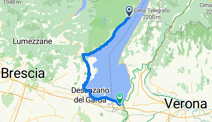
Overview
About this route
- 4 h 37 min
- Duration
- 67.6 km
- Distance
- 939 m
- Ascent
- 934 m
- Descent
- 14.7 km/h
- Avg. speed
- 263 m
- Max. altitude

Part of
garda lake
3 stages
Continue with Bikemap
Use, edit, or download this cycling route
You would like to ride Gardola - Peschiera del Garda or customize it for your own trip? Here is what you can do with this Bikemap route:
Free features
- Save this route as favorite or in collections
- Copy & plan your own version of this route
- Sync your route with Garmin or Wahoo
Premium features
Free trial for 3 days, or one-time payment. More about Bikemap Premium.
- Navigate this route on iOS & Android
- Export a GPX / KML file of this route
- Create your custom printout (try it for free)
- Download this route for offline navigation
Discover more Premium features.
Get Bikemap PremiumFrom our community
Other popular routes starting in Gardola
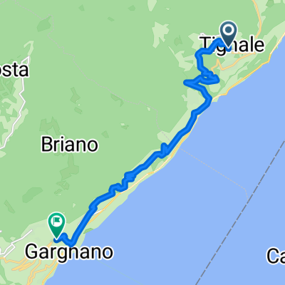
 l.di Garda - Tignale
- Distance
- 27.9 km
- Ascent
- 978 m
- Descent
- 997 m
- Location
- Gardola, Lombardy, Italy
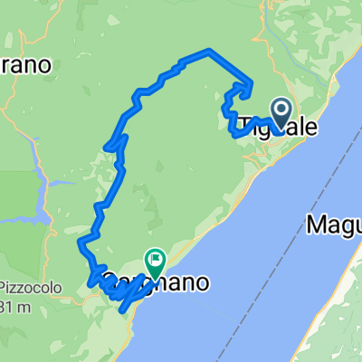
 Cima Tignale Hard Rock Trail
- Distance
- 27.6 km
- Ascent
- 1,170 m
- Descent
- 1,170 m
- Location
- Gardola, Lombardy, Italy
 rund um den Gardasee
- Distance
- 164 km
- Ascent
- 1,251 m
- Descent
- 781 m
- Location
- Gardola, Lombardy, Italy
 Gardola-Puria
- Distance
- 32.2 km
- Ascent
- 994 m
- Descent
- 979 m
- Location
- Gardola, Lombardy, Italy
 Da Gardola a Gargnano Via Prea
- Distance
- 13 km
- Ascent
- 824 m
- Descent
- 1,129 m
- Location
- Gardola, Lombardy, Italy
 Lange Ausfahrt durch Piovere
- Distance
- 59.9 km
- Ascent
- 1,467 m
- Descent
- 1,525 m
- Location
- Gardola, Lombardy, Italy
 Projekt
- Distance
- 35 km
- Ascent
- 1,604 m
- Descent
- 1,938 m
- Location
- Gardola, Lombardy, Italy
 Aufnahme vom 17.04.2017, 14:46
- Distance
- 106.3 km
- Ascent
- 1,700 m
- Descent
- 1,776 m
- Location
- Gardola, Lombardy, Italy
Open it in the app