
from flying fox - kava
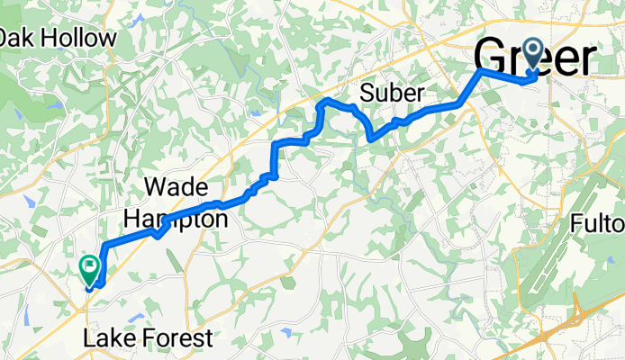
A cycling route starting in Greer, South Carolina, United States.
Overview
About this route
my fucking shoulders
- 2 h 25 min
- Duration
- 18.6 km
- Distance
- 238 m
- Ascent
- 239 m
- Descent
- 7.7 km/h
- Avg. speed
- 314 m
- Max. altitude

Route photos


Route quality
Waytypes & surfaces along the route
Waytypes
Quiet road
13.7 km
(74 %)
Road
3.9 km
(21 %)
Surfaces
Paved
10.2 km
(55 %)
Asphalt
9.1 km
(49 %)
Paved (undefined)
0.9 km
(5 %)
Continue with Bikemap
Use, edit, or download this cycling route
You would like to ride from flying fox - kava or customize it for your own trip? Here is what you can do with this Bikemap route:
Free features
- Save this route as favorite or in collections
- Copy & plan your own version of this route
- Sync your route with Garmin or Wahoo
Premium features
Free trial for 3 days, or one-time payment. More about Bikemap Premium.
- Navigate this route on iOS & Android
- Export a GPX / KML file of this route
- Create your custom printout (try it for free)
- Download this route for offline navigation
Discover more Premium features.
Get Bikemap PremiumFrom our community
Other popular routes starting in Greer
 home
home- Distance
- 7.3 km
- Ascent
- 113 m
- Descent
- 125 m
- Location
- Greer, South Carolina, United States
 105 N Miller St, Greer to 212–298 Ponder Ln, Taylors
- Distance
- 23.4 km
- Ascent
- 359 m
- Descent
- 296 m
- Location
- Greer, South Carolina, United States
 Easy ride in Greer
- Distance
- 0.8 km
- Ascent
- 8 m
- Descent
- 13 m
- Location
- Greer, South Carolina, United States
 50–106 S-42-2000, Greer to 2 Arborlea Ct, Greer
- Distance
- 13.5 km
- Ascent
- 114 m
- Descent
- 173 m
- Location
- Greer, South Carolina, United States
 from flying fox - kava
- Distance
- 18.6 km
- Ascent
- 238 m
- Descent
- 239 m
- Location
- Greer, South Carolina, United States
 211 School St, Greer to 211 N Buncombe Rd, Greer
- Distance
- 50.4 km
- Ascent
- 1,147 m
- Descent
- 1,112 m
- Location
- Greer, South Carolina, United States
 214 West Rd, Greer to 2–98 Colby Ct, Greer
- Distance
- 5.7 km
- Ascent
- 0 m
- Descent
- 20 m
- Location
- Greer, South Carolina, United States
 27 miles
- Distance
- 44 km
- Ascent
- 342 m
- Descent
- 343 m
- Location
- Greer, South Carolina, United States
Open it in the app