
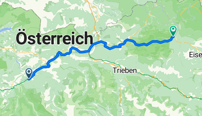
2. Öblarn-Hieflau
A cycling route starting in Öblarn, Styria, Austria.
Overview
About this route
- 5 h 51 min
- Duration
- 82.7 km
- Distance
- 1,683 m
- Ascent
- 1,818 m
- Descent
- 14.1 km/h
- Avg. speed
- 720 m
- Max. altitude

Continue with Bikemap
Use, edit, or download this cycling route
You would like to ride 2. Öblarn-Hieflau or customize it for your own trip? Here is what you can do with this Bikemap route:
Free features
- Save this route as favorite or in collections
- Copy & plan your own version of this route
- Split it into stages to create a multi-day tour
- Sync your route with Garmin or Wahoo
Premium features
Free trial for 3 days, or one-time payment. More about Bikemap Premium.
- Navigate this route on iOS & Android
- Export a GPX / KML file of this route
- Create your custom printout (try it for free)
- Download this route for offline navigation
Discover more Premium features.
Get Bikemap PremiumFrom our community
Other popular routes starting in Öblarn
 2. Öblarn-Hieflau
- Distance
- 82.7 km
- Ascent
- 1,683 m
- Descent
- 1,818 m
- Location
- Öblarn, Styria, Austria
 Mitterberg Tour
- Distance
- 18.5 km
- Ascent
- 318 m
- Descent
- 318 m
- Location
- Öblarn, Styria, Austria
 Grimming Tour
- Distance
- 50.8 km
- Ascent
- 836 m
- Descent
- 836 m
- Location
- Öblarn, Styria, Austria
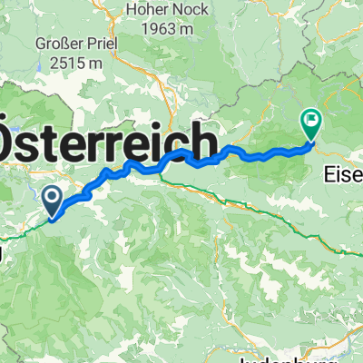
 2. Öblarn-Hieflau
- Distance
- 79.9 km
- Ascent
- 1,472 m
- Descent
- 1,606 m
- Location
- Öblarn, Styria, Austria
 Small Mitterberg Track
- Distance
- 15.3 km
- Ascent
- 270 m
- Descent
- 269 m
- Location
- Öblarn, Styria, Austria
 den1-b
- Distance
- 45.7 km
- Ascent
- 1,243 m
- Descent
- 1,241 m
- Location
- Öblarn, Styria, Austria
 TG13_Tag-11
- Distance
- 51.5 km
- Ascent
- 419 m
- Descent
- 376 m
- Location
- Öblarn, Styria, Austria
 Dachstein Tour
- Distance
- 46.7 km
- Ascent
- 1,311 m
- Descent
- 300 m
- Location
- Öblarn, Styria, Austria
Open it in the app