
Von Zeesen bis Grosshöchstetten
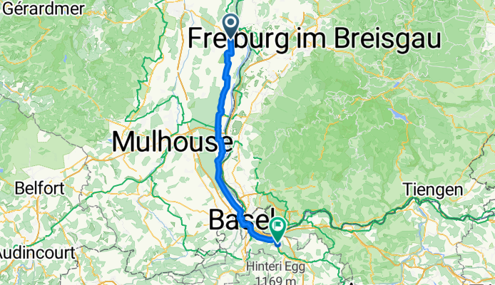
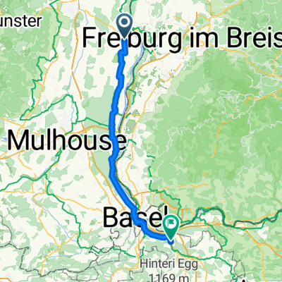
Algolsheim - Frenkendorf
A cycling route starting in Algolsheim, Grand Est, France.
Overview
About this route
- 4 h 18 min
- Duration
- 72.6 km
- Distance
- 278 m
- Ascent
- 146 m
- Descent
- 16.9 km/h
- Avg. speed
- 325 m
- Max. altitude
Part of
Von Zeesen bis Grosshöchstetten
14 stages
Route quality
Waytypes & surfaces along the route
Waytypes
Cycleway
41.4 km
(57 %)
Quiet road
13.8 km
(19 %)
Surfaces
Paved
55.9 km
(77 %)
Unpaved
12.3 km
(17 %)
Asphalt
52.3 km
(72 %)
Gravel
8 km
(11 %)
Continue with Bikemap
Use, edit, or download this cycling route
You would like to ride Algolsheim - Frenkendorf or customize it for your own trip? Here is what you can do with this Bikemap route:
Free features
- Save this route as favorite or in collections
- Copy & plan your own version of this route
- Sync your route with Garmin or Wahoo
Premium features
Free trial for 3 days, or one-time payment. More about Bikemap Premium.
- Navigate this route on iOS & Android
- Export a GPX / KML file of this route
- Create your custom printout (try it for free)
- Download this route for offline navigation
Discover more Premium features.
Get Bikemap PremiumFrom our community
Other popular routes starting in Algolsheim
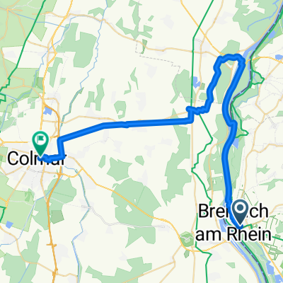
 Rheinstraße, Breisach am Rhein nach Hermann-Herder-Straße 7, Freiburg im Breisgau
- Distance
- 28.5 km
- Ascent
- 96 m
- Descent
- 17 m
- Location
- Algolsheim, Grand Est, France
 Breisach nach COLMAR - Rapp trace
- Distance
- 41.4 km
- Ascent
- 75 m
- Descent
- 72 m
- Location
- Algolsheim, Grand Est, France
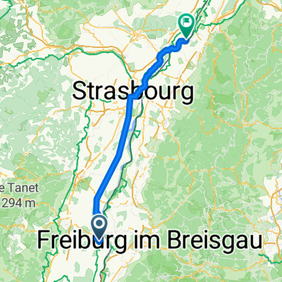
 Breisach1
- Distance
- 55.5 km
- Ascent
- 342 m
- Descent
- 339 m
- Location
- Algolsheim, Grand Est, France
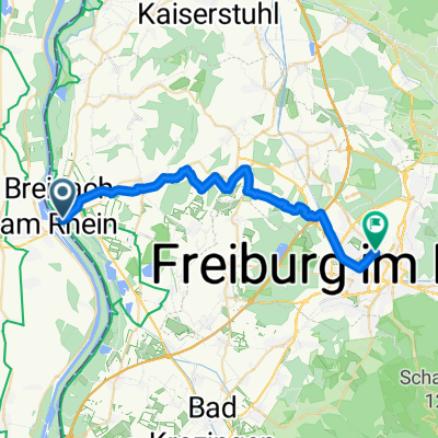 Von Breisach am Rhein bis Freiburg im Breisgau
- Distance
- 27.8 km
- Ascent
- 144 m
- Descent
- 74 m
- Location
- Algolsheim, Grand Est, France
 2 Geiswasser Rhinau
- Distance
- 62 km
- Ascent
- 59 m
- Descent
- 94 m
- Location
- Algolsheim, Grand Est, France
 Algolsheim - Hügelsheim
- Distance
- 115.7 km
- Ascent
- 126 m
- Descent
- 198 m
- Location
- Algolsheim, Grand Est, France
 Algolsheim - Frenkendorf
- Distance
- 72.6 km
- Ascent
- 278 m
- Descent
- 146 m
- Location
- Algolsheim, Grand Est, France
 CYCLING THE RHINE: Route 18B
- Distance
- 23.7 km
- Ascent
- 43 m
- Descent
- 35 m
- Location
- Algolsheim, Grand Est, France
Open it in the app