
Alajuela a Manzanillo
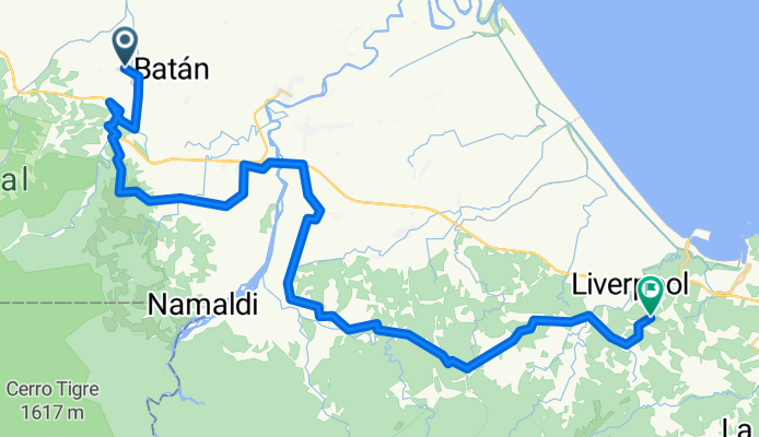
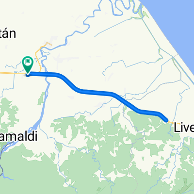
Batán - Puerto Limón
A cycling route starting in Batán, Limón Province, Costa Rica.
Overview
About this route
- 2 h 48 min
- Duration
- 56.2 km
- Distance
- 963 m
- Ascent
- 913 m
- Descent
- 20.1 km/h
- Avg. speed
- 290 m
- Max. altitude

Part of
Alajuela a Manzanillo
6 stages
Route quality
Waytypes & surfaces along the route
Waytypes
Quiet road
50 km
(89 %)
Cycleway
3.4 km
(6 %)
Road
2.8 km
(5 %)
Surfaces
Paved
6.7 km
(12 %)
Unpaved
3.9 km
(7 %)
Paved (undefined)
3.4 km
(6 %)
Asphalt
3.4 km
(6 %)
Continue with Bikemap
Use, edit, or download this cycling route
You would like to ride Batán - Puerto Limón or customize it for your own trip? Here is what you can do with this Bikemap route:
Free features
- Save this route as favorite or in collections
- Copy & plan your own version of this route
- Sync your route with Garmin or Wahoo
Premium features
Free trial for 3 days, or one-time payment. More about Bikemap Premium.
- Navigate this route on iOS & Android
- Export a GPX / KML file of this route
- Create your custom printout (try it for free)
- Download this route for offline navigation
Discover more Premium features.
Get Bikemap PremiumFrom our community
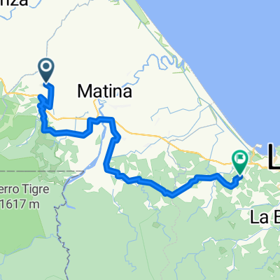
Other popular routes starting in Batán
 Batán - Puerto Limón
- Distance
- 56.2 km
- Ascent
- 963 m
- Descent
- 913 m
- Location
- Batán, Limón Province, Costa Rica
 De Batán a Pandora.
- Distance
- 85.8 km
- Ascent
- 1,029 m
- Descent
- 1,000 m
- Location
- Batán, Limón Province, Costa Rica
 Paseo lento
- Distance
- 31.6 km
- Ascent
- 688 m
- Descent
- 704 m
- Location
- Batán, Limón Province, Costa Rica
 Un viaje apasionante
- Distance
- 56.3 km
- Ascent
- 289 m
- Descent
- 297 m
- Location
- Batán, Limón Province, Costa Rica
 Paseo rápido
- Distance
- 58.8 km
- Ascent
- 169 m
- Descent
- 183 m
- Location
- Batán, Limón Province, Costa Rica
 Ruta moderata
- Distance
- 26 km
- Ascent
- 357 m
- Descent
- 363 m
- Location
- Batán, Limón Province, Costa Rica
 Paseo rápido
- Distance
- 53.7 km
- Ascent
- 87 m
- Descent
- 102 m
- Location
- Batán, Limón Province, Costa Rica
 Ruta deportiva en
- Distance
- 47.6 km
- Ascent
- 290 m
- Descent
- 285 m
- Location
- Batán, Limón Province, Costa Rica
Open it in the app