
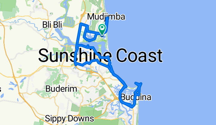
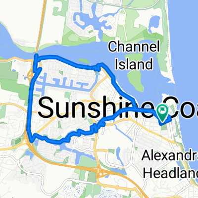
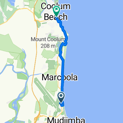
Novatel Twin Waters - Pt Cartwright Retun
A cycling route starting in Sunshine Coast, Queensland, Australia.
Overview
About this route
- 4 h 4 min
- Duration
- 52.8 km
- Distance
- 128 m
- Ascent
- 168 m
- Descent
- 13 km/h
- Avg. speed
- 48 m
- Max. altitude

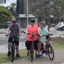
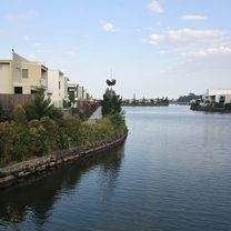
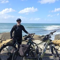
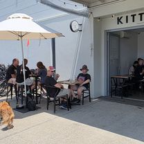
Route photos


Route quality
Waytypes & surfaces along the route
Waytypes
Cycleway
32.8 km
(62 %)
Quiet road
6.3 km
(12 %)
Surfaces
Paved
46.5 km
(88 %)
Concrete
29.1 km
(55 %)
Asphalt
9.5 km
(18 %)
Continue with Bikemap
Use, edit, or download this cycling route
You would like to ride Novatel Twin Waters - Pt Cartwright Retun or customize it for your own trip? Here is what you can do with this Bikemap route:
Free features
- Save this route as favorite or in collections
- Copy & plan your own version of this route
- Sync your route with Garmin or Wahoo
Premium features
Free trial for 3 days, or one-time payment. More about Bikemap Premium.
- Navigate this route on iOS & Android
- Export a GPX / KML file of this route
- Create your custom printout (try it for free)
- Download this route for offline navigation
Discover more Premium features.
Get Bikemap PremiumFrom our community
Other popular routes starting in Sunshine Coast
 Ocean Drive to Ocean Drive
- Distance
- 22.2 km
- Ascent
- 91 m
- Descent
- 132 m
- Location
- Sunshine Coast, Queensland, Australia
 Fifth Avenue to Fifth Avenue
- Distance
- 13.9 km
- Ascent
- 33 m
- Descent
- 76 m
- Location
- Sunshine Coast, Queensland, Australia
 Maroochydore Waters Loop
- Distance
- 12.8 km
- Ascent
- 15 m
- Descent
- 16 m
- Location
- Sunshine Coast, Queensland, Australia
 Novatel Twin Waters - Pt Cartwright Retun
- Distance
- 52.8 km
- Ascent
- 128 m
- Descent
- 168 m
- Location
- Sunshine Coast, Queensland, Australia
 Beach Parade to Beach Parade
- Distance
- 13.2 km
- Ascent
- 47 m
- Descent
- 93 m
- Location
- Sunshine Coast, Queensland, Australia
 Chemist Warehouse Marcoola
- Distance
- 9.9 km
- Ascent
- 92 m
- Descent
- 72 m
- Location
- Sunshine Coast, Queensland, Australia
 Novotel Twin Waters to Point Cartwright Lighthouse
- Distance
- 49 km
- Ascent
- 67 m
- Descent
- 67 m
- Location
- Sunshine Coast, Queensland, Australia
 Maroochydore Town Centre to Cotton Tree & Fisherman's Road Markets
- Distance
- 16.5 km
- Ascent
- 44 m
- Descent
- 48 m
- Location
- Sunshine Coast, Queensland, Australia
Open it in the app