

Oytalhaus ab Bolsterlang
A cycling route starting in Obermaiselstein, Bavaria, Germany.
Overview
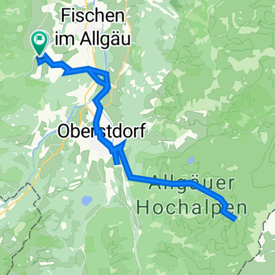
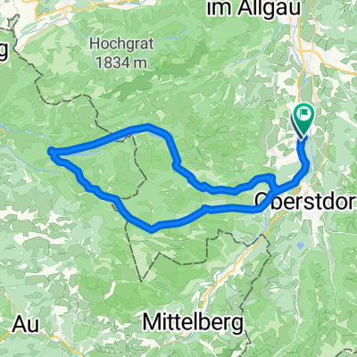
About this route
Easy cycling route with only one steep climb, namely directly at the ski jumping stadium in Oberstdorf, and of course before Bolsterlang on the way back. Also doable with children if they have some stamina. Stop at the Oytalhaus with a nice beer garden and playground. The way back leaves the paved road and follows beautifully along the Oybach stream and later the Trettach. Nice play areas for children by the stream.
- -:--
- Duration
- 32.7 km
- Distance
- 411 m
- Ascent
- 411 m
- Descent
- ---
- Avg. speed
- ---
- Max. altitude

Continue with Bikemap
Use, edit, or download this cycling route
You would like to ride Oytalhaus ab Bolsterlang or customize it for your own trip? Here is what you can do with this Bikemap route:
Free features
- Save this route as favorite or in collections
- Copy & plan your own version of this route
- Sync your route with Garmin or Wahoo
Premium features
Free trial for 3 days, or one-time payment. More about Bikemap Premium.
- Navigate this route on iOS & Android
- Export a GPX / KML file of this route
- Create your custom printout (try it for free)
- Download this route for offline navigation
Discover more Premium features.
Get Bikemap PremiumFrom our community
Other popular routes starting in Obermaiselstein
 AT - Transalp - Obersdorf - Riva del Garda
- Distance
- 358.3 km
- Ascent
- 6,190 m
- Descent
- 6,888 m
- Location
- Obermaiselstein, Bavaria, Germany
 Oytal/ Wasserfall
- Distance
- 39.9 km
- Ascent
- 798 m
- Descent
- 787 m
- Location
- Obermaiselstein, Bavaria, Germany
 Ostein-Hinterstein
- Distance
- 23.3 km
- Ascent
- 216 m
- Descent
- 179 m
- Location
- Obermaiselstein, Bavaria, Germany
 kurze Riedbergpassrunde
- Distance
- 75 km
- Ascent
- 1,076 m
- Descent
- 1,332 m
- Location
- Obermaiselstein, Bavaria, Germany
 Oytalhaus ab Bolsterlang
- Distance
- 32.7 km
- Ascent
- 411 m
- Descent
- 411 m
- Location
- Obermaiselstein, Bavaria, Germany
 20090721 Obermaiselstein - Oberstdorf
- Distance
- 32.7 km
- Ascent
- 251 m
- Descent
- 256 m
- Location
- Obermaiselstein, Bavaria, Germany
 Tiefenbach Sibratsgfäll Lochbachtal Tiefenbach
- Distance
- 60.2 km
- Ascent
- 1,763 m
- Descent
- 1,759 m
- Location
- Obermaiselstein, Bavaria, Germany
 Obermaiselstein-Riedberpass-Hörnlepass
- Distance
- 61.5 km
- Ascent
- 1,167 m
- Descent
- 1,167 m
- Location
- Obermaiselstein, Bavaria, Germany
Open it in the app