![Ph0]에서 경로탕정면 856-1](/_next/static/media/contour-lines-light-small.cafd5e5d.avif)
![Ph0]에서 경로탕정면 856-1](https://media.bikemap.net/routes/17482492/staticmaps/in_9fc5bc52-a5d1-4870-b686-8adc892c1b91_694x400_bikemap-2021-3D-static.png)
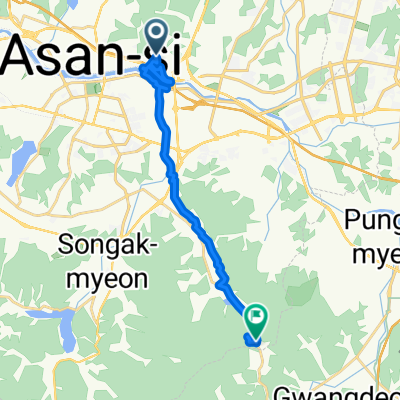
Ph0]에서 경로탕정면 856-1
A cycling route starting in Asan, Chungcheongnam-do, South Korea.
Overview
About this route
- 1 h 32 min
- Duration
- 24.9 km
- Distance
- 432 m
- Ascent
- 277 m
- Descent
- 16.3 km/h
- Avg. speed
- 195 m
- Max. altitude

Route quality
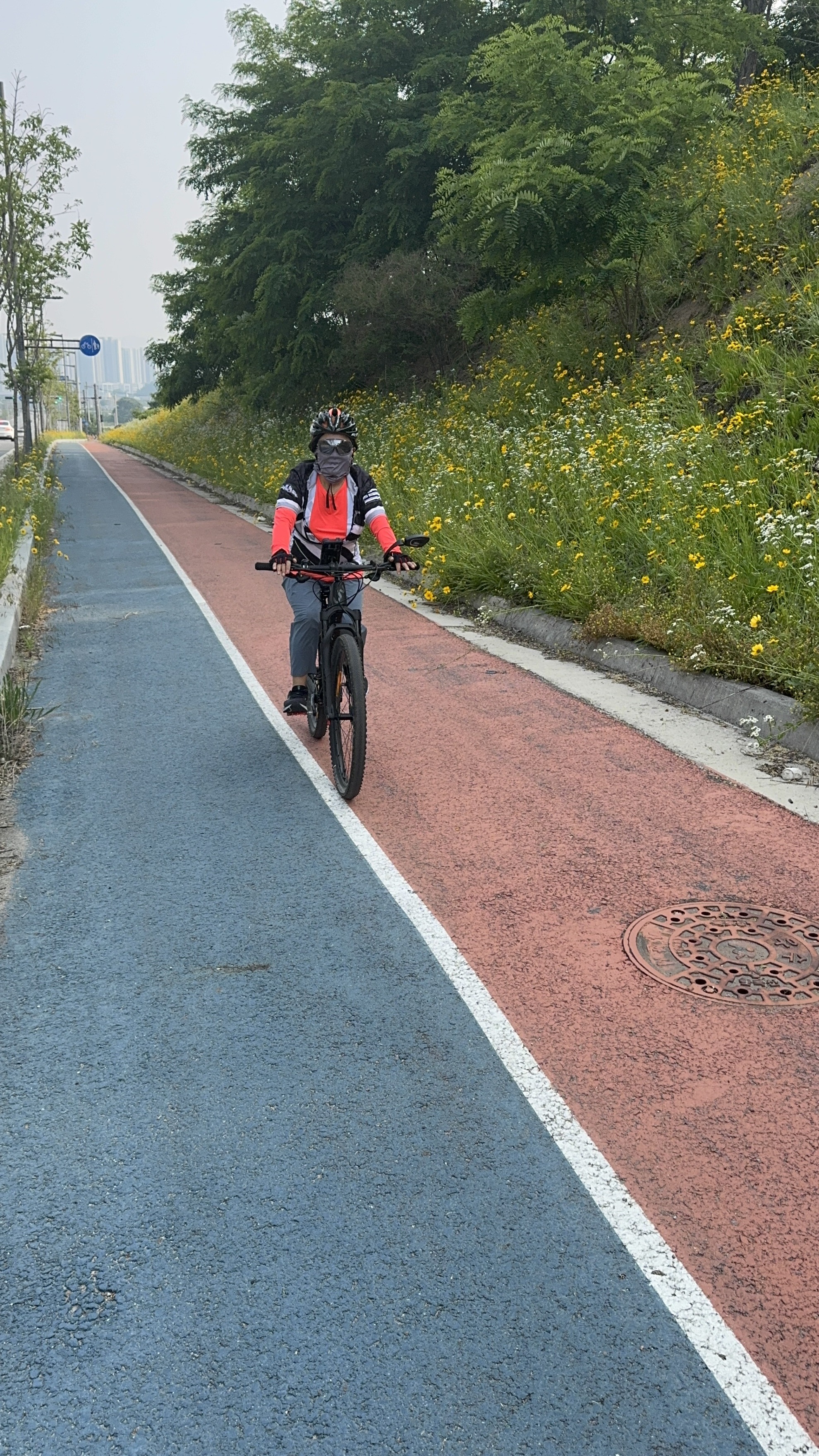
Waytypes & surfaces along the route
Waytypes
Cycleway
10.2 km
(41 %)
Quiet road
8 km
(32 %)
Surfaces
Paved
2.7 km
(11 %)
Asphalt
1.2 km
(5 %)
Concrete
1.2 km
(5 %)
Continue with Bikemap
Use, edit, or download this cycling route
You would like to ride Ph0]에서 경로탕정면 856-1 or customize it for your own trip? Here is what you can do with this Bikemap route:
Free features
- Save this route as favorite or in collections
- Copy & plan your own version of this route
- Sync your route with Garmin or Wahoo
Premium features
Free trial for 3 days, or one-time payment. More about Bikemap Premium.
- Navigate this route on iOS & Android
- Export a GPX / KML file of this route
- Create your custom printout (try it for free)
- Download this route for offline navigation
Discover more Premium features.
Get Bikemap PremiumFrom our community
Other popular routes starting in Asan
 염치읍 301-2 ~ 배방읍 54-3
- Distance
- 17.9 km
- Ascent
- 248 m
- Descent
- 68 m
- Location
- Asan, Chungcheongnam-do, South Korea
 용화동, 아산시 to 용화동, 아산시
- Distance
- 35.5 km
- Ascent
- 256 m
- Descent
- 255 m
- Location
- Asan, Chungcheongnam-do, South Korea
 От 307-3 권곡동, 아산시 до 697 신부동, 천안시
- Distance
- 20.3 km
- Ascent
- 1,075 m
- Descent
- 1,040 m
- Location
- Asan, Chungcheongnam-do, South Korea
 2025.8.28오후
- Distance
- 44.8 km
- Ascent
- 199 m
- Descent
- 194 m
- Location
- Asan, Chungcheongnam-do, South Korea
 2025.9.7 저녁
- Distance
- 30.4 km
- Ascent
- 184 m
- Descent
- 223 m
- Location
- Asan, Chungcheongnam-do, South Korea
 2025.9.9
- Distance
- 46.2 km
- Ascent
- 198 m
- Descent
- 248 m
- Location
- Asan, Chungcheongnam-do, South Korea
![Ph0]에서 경로탕정면 856-1](https://media.bikemap.net/routes/17482492/staticmaps/in_9fc5bc52-a5d1-4870-b686-8adc892c1b91_400x400_bikemap-2021-3D-static.png) Ph0]에서 경로탕정면 856-1
Ph0]에서 경로탕정면 856-1- Distance
- 24.9 km
- Ascent
- 432 m
- Descent
- 277 m
- Location
- Asan, Chungcheongnam-do, South Korea
 work route main
- Distance
- 15.5 km
- Ascent
- 129 m
- Descent
- 177 m
- Location
- Asan, Chungcheongnam-do, South Korea
Open it in the app