
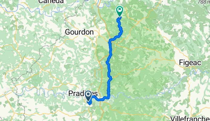
Cahors to Rocamadour - V87 Route
A cycling route starting in Cahors, Occitanie, France.
Overview
About this route
The V87 was a wonderfully scenic and challenging route from Cahors to Rocamadour. With the exception of the first part of the ride when there was some pretty flat riding on a rails to trails section, there were plenty of ups and downs.
All roads were excellent paved cycling path and low traffic roads, with one exception of a short time on an overgrown partly paved one lane road.
- 5 h 51 min
- Duration
- 66.4 km
- Distance
- 995 m
- Ascent
- 1,016 m
- Descent
- 11.3 km/h
- Avg. speed
- 450 m
- Max. altitude

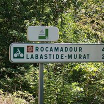
Route photos


Route quality
Waytypes & surfaces along the route
Waytypes
Busy road
26.5 km
(40 %)
Quiet road
23.9 km
(36 %)
Surfaces
Paved
19.4 km
(29 %)
Asphalt
19.1 km
(29 %)
Paving stones
0.2 km
(<1 %)
Continue with Bikemap
Use, edit, or download this cycling route
You would like to ride Cahors to Rocamadour - V87 Route or customize it for your own trip? Here is what you can do with this Bikemap route:
Free features
- Save this route as favorite or in collections
- Copy & plan your own version of this route
- Sync your route with Garmin or Wahoo
Premium features
Free trial for 3 days, or one-time payment. More about Bikemap Premium.
- Navigate this route on iOS & Android
- Export a GPX / KML file of this route
- Create your custom printout (try it for free)
- Download this route for offline navigation
Discover more Premium features.
Get Bikemap PremiumFrom our community
Other popular routes starting in Cahors
 Cahors - Circle through Goudon and Le Vigan
- Distance
- 88.2 km
- Ascent
- 1,051 m
- Descent
- 1,051 m
- Location
- Cahors, Occitanie, France
 Gramat anders
- Distance
- 92.2 km
- Ascent
- 2,089 m
- Descent
- 2,145 m
- Location
- Cahors, Occitanie, France
 Cahors to Rocamadour - V87 Route
- Distance
- 66.4 km
- Ascent
- 995 m
- Descent
- 1,016 m
- Location
- Cahors, Occitanie, France
 Cahors - Ride to St-Pierre-Lafeuille and Return
- Distance
- 15.9 km
- Ascent
- 287 m
- Descent
- 290 m
- Location
- Cahors, Occitanie, France
 Cargolate été 2021 étape 7
- Distance
- 39.9 km
- Ascent
- 485 m
- Descent
- 321 m
- Location
- Cahors, Occitanie, France
 Cahors - St. Gaudens
- Distance
- 200.5 km
- Ascent
- 869 m
- Descent
- 596 m
- Location
- Cahors, Occitanie, France
 Cahors-Fumel 57 km
- Distance
- 57 km
- Ascent
- 384 m
- Descent
- 430 m
- Location
- Cahors, Occitanie, France
 Cahors to La Forge (Souillac)
- Distance
- 71.6 km
- Ascent
- 835 m
- Descent
- 840 m
- Location
- Cahors, Occitanie, France
Open it in the app