
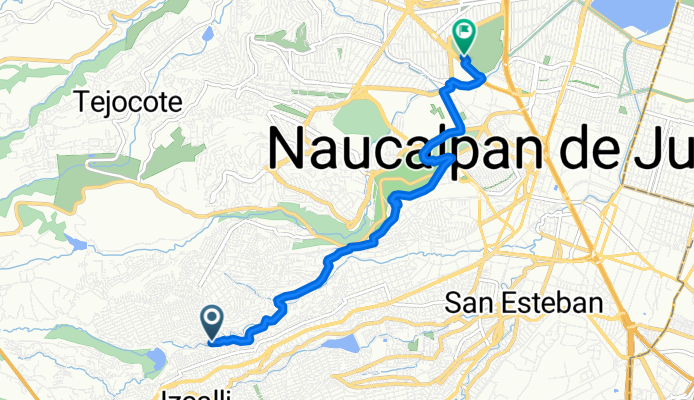
De Sauce a parque Naucalli
A cycling route starting in Ejido del Tejocote, State of Mexico, Mexico.
Overview
About this route
- 1 h 25 min
- Duration
- 9.2 km
- Distance
- 244 m
- Ascent
- 319 m
- Descent
- 6.4 km/h
- Avg. speed
- 2,415 m
- Max. altitude

Route photos


Continue with Bikemap
Use, edit, or download this cycling route
You would like to ride De Sauce a parque Naucalli or customize it for your own trip? Here is what you can do with this Bikemap route:
Free features
- Save this route as favorite or in collections
- Copy & plan your own version of this route
- Sync your route with Garmin or Wahoo
Premium features
Free trial for 3 days, or one-time payment. More about Bikemap Premium.
- Navigate this route on iOS & Android
- Export a GPX / KML file of this route
- Create your custom printout (try it for free)
- Download this route for offline navigation
Discover more Premium features.
Get Bikemap PremiumFrom our community
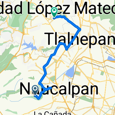
Other popular routes starting in Ejido del Tejocote
 De Felipe Angeles 7, Naucalpan de Juárez a Adolfo López Mateos 47, Naucalpan de Juárez
- Distance
- 4.4 km
- Ascent
- 45 m
- Descent
- 154 m
- Location
- Ejido del Tejocote, State of Mexico, Mexico
 Bugambilias 3, Naucalpan de Juárez to Calzada Acalotenco 237, Ciudad de México
- Distance
- 12.3 km
- Ascent
- 8 m
- Descent
- 70 m
- Location
- Ejido del Tejocote, State of Mexico, Mexico
 De Sauce a parque Naucalli
- Distance
- 9.2 km
- Ascent
- 244 m
- Descent
- 319 m
- Location
- Ejido del Tejocote, State of Mexico, Mexico
 casa yuh
- Distance
- 25.6 km
- Ascent
- 32 m
- Descent
- 206 m
- Location
- Ejido del Tejocote, State of Mexico, Mexico
 De Calle Diamante 1, Naucalpan de Juárez a Calle Campo Cantemoc 224, Ciudad de México
- Distance
- 19.4 km
- Ascent
- 249 m
- Descent
- 311 m
- Location
- Ejido del Tejocote, State of Mexico, Mexico
 parque 5 Mayo a glorieta Camarones
- Distance
- 11.6 km
- Ascent
- 18 m
- Descent
- 93 m
- Location
- Ejido del Tejocote, State of Mexico, Mexico
 San Mateo Nopala to Arboledas
- Distance
- 20 km
- Ascent
- 124 m
- Descent
- 247 m
- Location
- Ejido del Tejocote, State of Mexico, Mexico
 Ruta desde Calle Diamante 4, Naucalpan de Juárez
- Distance
- 24.1 km
- Ascent
- 572 m
- Descent
- 648 m
- Location
- Ejido del Tejocote, State of Mexico, Mexico
Open it in the app