

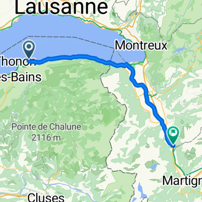
Dag 13 Rondrit Thonon-les-Bains
A cycling route starting in Publier, Auvergne-Rhône-Alpes, France.
Overview
About this route
Round trip
Around Lake Geneva 2012
Round trip through the Haute Savoie with a lot of climbing in the first part. You start by gaining some height when leaving Thonon les Bains (8.3 km). Then come successively the Col du Feu (1117 m, 7.4 km), the steep climb to the Col des Arces (1163 m, 3.9 km), the Col de Terramont (1096 m, 2.8 km) and the take-along col (you arrive there after a bit of descending) Col de Jambaz (1027 m). Afterwards, you mainly descend towards Lake Léman…
- -:--
- Duration
- 66.1 km
- Distance
- 1,264 m
- Ascent
- 1,264 m
- Descent
- ---
- Avg. speed
- ---
- Max. altitude
Route quality
Waytypes & surfaces along the route
Waytypes
Road
21.8 km
(33 %)
Quiet road
9.3 km
(14 %)
Surfaces
Paved
54.9 km
(83 %)
Asphalt
54.9 km
(83 %)
Undefined
11.2 km
(17 %)
Continue with Bikemap
Use, edit, or download this cycling route
You would like to ride Dag 13 Rondrit Thonon-les-Bains or customize it for your own trip? Here is what you can do with this Bikemap route:
Free features
- Save this route as favorite or in collections
- Copy & plan your own version of this route
- Sync your route with Garmin or Wahoo
Premium features
Free trial for 3 days, or one-time payment. More about Bikemap Premium.
- Navigate this route on iOS & Android
- Export a GPX / KML file of this route
- Create your custom printout (try it for free)
- Download this route for offline navigation
Discover more Premium features.
Get Bikemap PremiumFrom our community
Other popular routes starting in Publier
 Dag 13 Rondrit Thonon-les-Bains
- Distance
- 66.1 km
- Ascent
- 1,264 m
- Descent
- 1,264 m
- Location
- Publier, Auvergne-Rhône-Alpes, France
 2 Park Dranse - Bois Noir
- Distance
- 57.7 km
- Ascent
- 245 m
- Descent
- 165 m
- Location
- Publier, Auvergne-Rhône-Alpes, France
 Bons-en-Chablais kort
- Distance
- 52.7 km
- Ascent
- 564 m
- Descent
- 559 m
- Location
- Publier, Auvergne-Rhône-Alpes, France
 Lugrin
- Distance
- 37.7 km
- Ascent
- 501 m
- Descent
- 500 m
- Location
- Publier, Auvergne-Rhône-Alpes, France
 Corsier
- Distance
- 76.8 km
- Ascent
- 640 m
- Descent
- 635 m
- Location
- Publier, Auvergne-Rhône-Alpes, France
 Boëge
Boëge- Distance
- 74.5 km
- Ascent
- 1,191 m
- Descent
- 1,188 m
- Location
- Publier, Auvergne-Rhône-Alpes, France
 RdGA 2022 - Tag 1 - Variante
- Distance
- 87.9 km
- Ascent
- 2,524 m
- Descent
- 1,842 m
- Location
- Publier, Auvergne-Rhône-Alpes, France
 Hermance
- Distance
- 62.1 km
- Ascent
- 452 m
- Descent
- 449 m
- Location
- Publier, Auvergne-Rhône-Alpes, France
Open it in the app