
GAP Pittsburgh to Cumberland
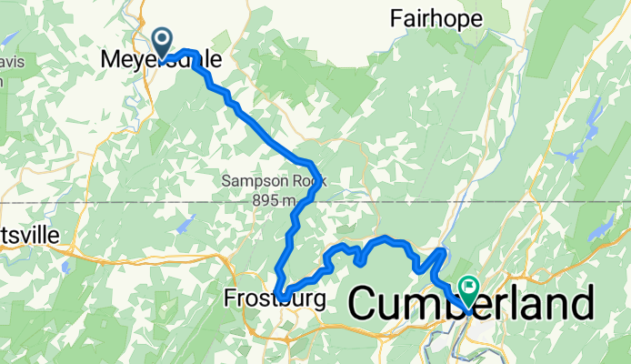
Meyersdale - Cumberland
A cycling route starting in Meyersdale, Pennsylvania, United States.
Overview
About this route
- 3 h 11 min
- Duration
- 52.1 km
- Distance
- 1,066 m
- Ascent
- 1,481 m
- Descent
- 16.4 km/h
- Avg. speed
- 757 m
- Max. altitude

Part of
GAP Pittsburgh to Cumberland
4 stages
Route quality
Waytypes & surfaces along the route
Waytypes
Cycleway
51.6 km
(99 %)
Undefined
0.5 km
(1 %)
Surfaces
Paved
4.2 km
(8 %)
Unpaved
46.9 km
(90 %)
Gravel
25 km
(48 %)
Loose gravel
21.9 km
(42 %)
Continue with Bikemap
Use, edit, or download this cycling route
You would like to ride Meyersdale - Cumberland or customize it for your own trip? Here is what you can do with this Bikemap route:
Free features
- Save this route as favorite or in collections
- Copy & plan your own version of this route
- Sync your route with Garmin or Wahoo
Premium features
Free trial for 3 days, or one-time payment. More about Bikemap Premium.
- Navigate this route on iOS & Android
- Export a GPX / KML file of this route
- Create your custom printout (try it for free)
- Download this route for offline navigation
Discover more Premium features.
Get Bikemap PremiumFrom our community
Other popular routes starting in Meyersdale
 Meyersdale - Connelsville
- Distance
- 92.1 km
- Ascent
- 66 m
- Descent
- 400 m
- Location
- Meyersdale, Pennsylvania, United States
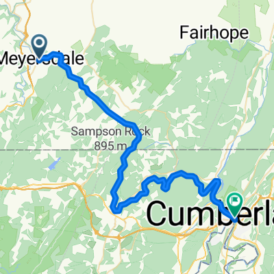 Meyersdale - Cumberland
- Distance
- 52.1 km
- Ascent
- 1,066 m
- Descent
- 1,481 m
- Location
- Meyersdale, Pennsylvania, United States
 Meyers Avenue 116, Meyersdale to Main Street 690, Rockwood
- Distance
- 20.8 km
- Ascent
- 218 m
- Descent
- 276 m
- Location
- Meyersdale, Pennsylvania, United States
 GAP Day?
- Distance
- 120.9 km
- Ascent
- 42 m
- Descent
- 488 m
- Location
- Meyersdale, Pennsylvania, United States
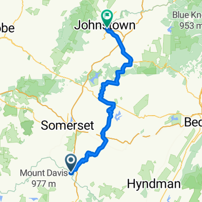 September 11 National Memorial Trail: Garrett to Johnstown
- Distance
- 84.8 km
- Ascent
- 891 m
- Descent
- 1,118 m
- Location
- Meyersdale, Pennsylvania, United States
 Route to 125 W High St, Hancock
- Distance
- 111 km
- Ascent
- 1,932 m
- Descent
- 2,436 m
- Location
- Meyersdale, Pennsylvania, United States
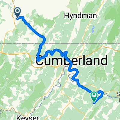 Meyersdale - Fort Ashby
- Distance
- 85.2 km
- Ascent
- 1,173 m
- Descent
- 1,596 m
- Location
- Meyersdale, Pennsylvania, United States
 Berlin Street 1787, Garrett to Great Allegheny Passage
- Distance
- 24.6 km
- Ascent
- 390 m
- Descent
- 252 m
- Location
- Meyersdale, Pennsylvania, United States
Open it in the app