
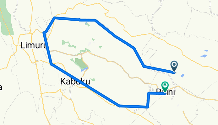
Easy ride
A cycling route starting in Kiambu, Kiambu County, Kenya.
Overview
About this route
- 3 h 59 min
- Duration
- 31.9 km
- Distance
- 394 m
- Ascent
- 340 m
- Descent
- 8 km/h
- Avg. speed
- 2,299 m
- Max. altitude

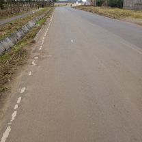
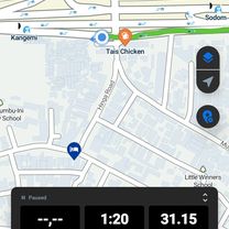
Route photos


Continue with Bikemap
Use, edit, or download this cycling route
You would like to ride Easy ride or customize it for your own trip? Here is what you can do with this Bikemap route:
Free features
- Save this route as favorite or in collections
- Copy & plan your own version of this route
- Sync your route with Garmin or Wahoo
Premium features
Free trial for 3 days, or one-time payment. More about Bikemap Premium.
- Navigate this route on iOS & Android
- Export a GPX / KML file of this route
- Create your custom printout (try it for free)
- Download this route for offline navigation
Discover more Premium features.
Get Bikemap PremiumFrom our community
Other popular routes starting in Kiambu
 Slow ride
- Distance
- 31.1 km
- Ascent
- 198 m
- Descent
- 199 m
- Location
- Kiambu, Kiambu County, Kenya
 Easy ride
- Distance
- 9.7 km
- Ascent
- 182 m
- Descent
- 160 m
- Location
- Kiambu, Kiambu County, Kenya
 Thindigua Highway Street to Road, Kiambu
- Distance
- 3.2 km
- Ascent
- 20 m
- Descent
- 61 m
- Location
- Kiambu, Kiambu County, Kenya
 High-speed route
- Distance
- 31.1 km
- Ascent
- 419 m
- Descent
- 111 m
- Location
- Kiambu, Kiambu County, Kenya
 Unnamed Road to Eastern By Pass, Ruiru
- Distance
- 19.1 km
- Ascent
- 0 m
- Descent
- 148 m
- Location
- Kiambu, Kiambu County, Kenya
 Kiamumbi Road, Nairobi to Container, Nairobi
- Distance
- 19.7 km
- Ascent
- 124 m
- Descent
- 130 m
- Location
- Kiambu, Kiambu County, Kenya
 Easy ride
- Distance
- 31.9 km
- Ascent
- 394 m
- Descent
- 340 m
- Location
- Kiambu, Kiambu County, Kenya
 Simon Kaniu Lane, Kiambu to Runda Grove, Nairobi
- Distance
- 5.3 km
- Ascent
- 55 m
- Descent
- 16 m
- Location
- Kiambu, Kiambu County, Kenya
Open it in the app