
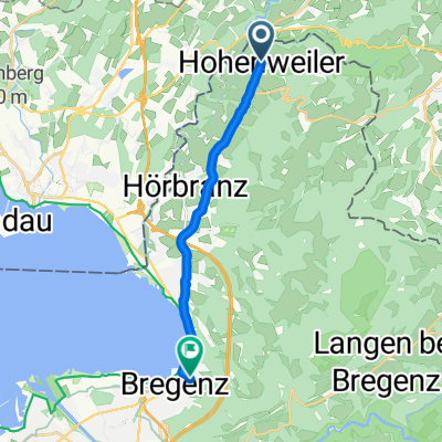
Bruck nach Martinstorplatz
A cycling route starting in Hohenweiler, Vorarlberg, Austria.
Overview
About this route
- 1 h 2 min
- Duration
- 18.1 km
- Distance
- 231 m
- Ascent
- 167 m
- Descent
- 17.6 km/h
- Avg. speed
- 577 m
- Max. altitude

Route photos

Route quality
Waytypes & surfaces along the route
Waytypes
Quiet road
11.8 km
(65 %)
Path
3.4 km
(19 %)
Surfaces
Paved
17.4 km
(96 %)
Unpaved
0.4 km
(2 %)
Asphalt
17.4 km
(96 %)
Gravel
0.4 km
(2 %)
Undefined
0.4 km
(2 %)
Continue with Bikemap
Use, edit, or download this cycling route
You would like to ride Bruck nach Martinstorplatz or customize it for your own trip? Here is what you can do with this Bikemap route:
Free features
- Save this route as favorite or in collections
- Copy & plan your own version of this route
- Sync your route with Garmin or Wahoo
Premium features
Free trial for 3 days, or one-time payment. More about Bikemap Premium.
- Navigate this route on iOS & Android
- Export a GPX / KML file of this route
- Create your custom printout (try it for free)
- Download this route for offline navigation
Discover more Premium features.
Get Bikemap PremiumFrom our community
Other popular routes starting in Hohenweiler
 denis
denis- Distance
- 22.4 km
- Ascent
- 86 m
- Descent
- 145 m
- Location
- Hohenweiler, Vorarlberg, Austria
 Egghaldenstraße 3, Sigmarszell to L1 18, Lochau
- Distance
- 53.7 km
- Ascent
- 722 m
- Descent
- 777 m
- Location
- Hohenweiler, Vorarlberg, Austria
 Hinunter zur Pfänderbahn
- Distance
- 10.4 km
- Ascent
- 26 m
- Descent
- 126 m
- Location
- Hohenweiler, Vorarlberg, Austria
 Bruck nach Bruggerhorn
- Distance
- 26.4 km
- Ascent
- 90 m
- Descent
- 179 m
- Location
- Hohenweiler, Vorarlberg, Austria
 Hohenweiler - Wangen - Lindenberg
- Distance
- 55 km
- Ascent
- 458 m
- Descent
- 512 m
- Location
- Hohenweiler, Vorarlberg, Austria
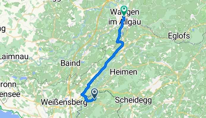
 Tour 2009 1. Etappe über Berg bis Scheidegg
- Distance
- 27.5 km
- Ascent
- 779 m
- Descent
- 462 m
- Location
- Hohenweiler, Vorarlberg, Austria
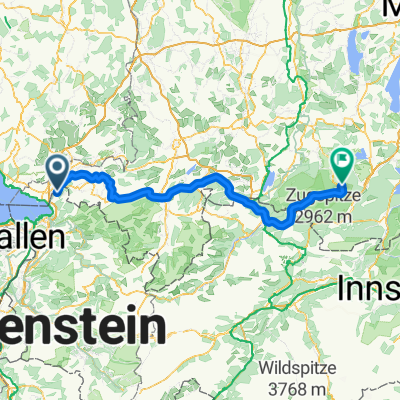 Ride Paris - Münich Etape 6
- Distance
- 140.2 km
- Ascent
- 1,041 m
- Descent
- 681 m
- Location
- Hohenweiler, Vorarlberg, Austria
 hohenweiler - scheidegg - weiler - langen - fluh
- Distance
- 45 km
- Ascent
- 1,002 m
- Descent
- 1,064 m
- Location
- Hohenweiler, Vorarlberg, Austria
Open it in the app