
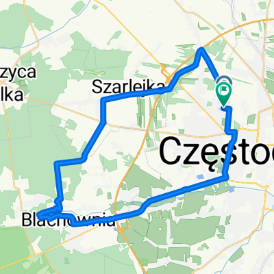
Wacława Sieroszewskiego do Wacława Sieroszewskiego
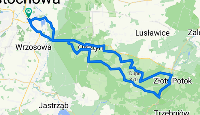
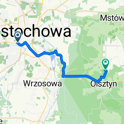
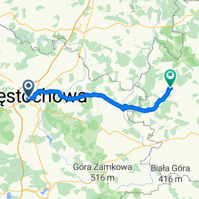
A cycling route starting in Częstochowa, Silesian Voivodeship, Poland.
Overview
About this route
- 4 h 49 min
- Duration
- 63.9 km
- Distance
- 461 m
- Ascent
- 502 m
- Descent
- 13.3 km/h
- Avg. speed
- 359 m
- Max. altitude

Route quality
Waytypes & surfaces along the route
Waytypes
Path
19.2 km
(30 %)
Quiet road
18.5 km
(29 %)
Surfaces
Paved
37 km
(58 %)
Unpaved
13.4 km
(21 %)
Asphalt
34.5 km
(54 %)
Gravel
7.7 km
(12 %)
Continue with Bikemap
Use, edit, or download this cycling route
You would like to ride Wacława Sieroszewskiego do Wacława Sieroszewskiego or customize it for your own trip? Here is what you can do with this Bikemap route:
Free features
- Save this route as favorite or in collections
- Copy & plan your own version of this route
- Sync your route with Garmin or Wahoo
Premium features
Free trial for 3 days, or one-time payment. More about Bikemap Premium.
- Navigate this route on iOS & Android
- Export a GPX / KML file of this route
- Create your custom printout (try it for free)
- Download this route for offline navigation
Discover more Premium features.
Get Bikemap PremiumFrom our community
Other popular routes starting in Częstochowa
 cały czas prosto
- Distance
- 11.9 km
- Ascent
- 90 m
- Descent
- 89 m
- Location
- Częstochowa, Silesian Voivodeship, Poland
 Generała Kazimierza Pułaskiego do Olsztyn
- Distance
- 18.7 km
- Ascent
- 121 m
- Descent
- 50 m
- Location
- Częstochowa, Silesian Voivodeship, Poland
 Lengthy bike tour through Częstochowa
- Distance
- 117.6 km
- Ascent
- 374 m
- Descent
- 370 m
- Location
- Częstochowa, Silesian Voivodeship, Poland
 Murów,Srocko,Kusięta,Olsztyn,Częstochowa
- Distance
- 39.7 km
- Ascent
- 216 m
- Descent
- 209 m
- Location
- Częstochowa, Silesian Voivodeship, Poland
 Klasztorna do Wiśniowa
- Distance
- 83.3 km
- Ascent
- 533 m
- Descent
- 633 m
- Location
- Częstochowa, Silesian Voivodeship, Poland
 Rybacka, Częstochowa to Rybacka, Częstochowa
- Distance
- 33.1 km
- Ascent
- 168 m
- Descent
- 175 m
- Location
- Częstochowa, Silesian Voivodeship, Poland
 Szlak Orlich Gniazd
- Distance
- 184.3 km
- Ascent
- 769 m
- Descent
- 812 m
- Location
- Częstochowa, Silesian Voivodeship, Poland
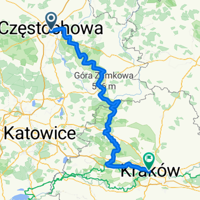
 CZWA-Kraków
- Distance
- 160.8 km
- Ascent
- 770 m
- Descent
- 808 m
- Location
- Częstochowa, Silesian Voivodeship, Poland
Open it in the app