
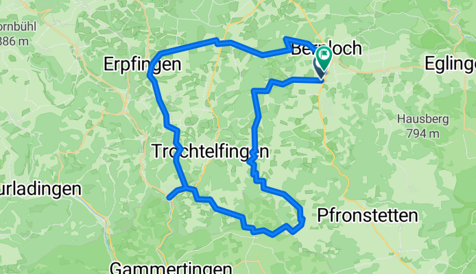
Hohenstein-Augstberg-Lauchert-See-Erpfingen
A cycling route starting in Trochtelfingen, Baden-Wurttemberg, Germany.
Overview
About this route
- 3 h 10 min
- Duration
- 47.2 km
- Distance
- 744 m
- Ascent
- 744 m
- Descent
- 14.9 km/h
- Avg. speed
- 847 m
- Max. altitude

Route quality
Waytypes & surfaces along the route
Waytypes
Track
24.6 km
(52 %)
Quiet road
18.4 km
(39 %)
Surfaces
Paved
33.5 km
(71 %)
Unpaved
9.9 km
(21 %)
Asphalt
28.8 km
(61 %)
Gravel
7.6 km
(16 %)
Continue with Bikemap
Use, edit, or download this cycling route
You would like to ride Hohenstein-Augstberg-Lauchert-See-Erpfingen or customize it for your own trip? Here is what you can do with this Bikemap route:
Free features
- Save this route as favorite or in collections
- Copy & plan your own version of this route
- Sync your route with Garmin or Wahoo
Premium features
Free trial for 3 days, or one-time payment. More about Bikemap Premium.
- Navigate this route on iOS & Android
- Export a GPX / KML file of this route
- Create your custom printout (try it for free)
- Download this route for offline navigation
Discover more Premium features.
Get Bikemap PremiumFrom our community
Other popular routes starting in Trochtelfingen
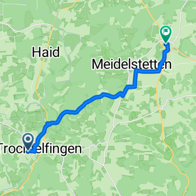 Kapelleschweg, Trochtelfingen nach Fasanenweg, Hohenstein
- Distance
- 11.6 km
- Ascent
- 220 m
- Descent
- 182 m
- Location
- Trochtelfingen, Baden-Wurttemberg, Germany
 Radrunde vom 1. Oktober, 14:53
- Distance
- 21.9 km
- Ascent
- 324 m
- Descent
- 342 m
- Location
- Trochtelfingen, Baden-Wurttemberg, Germany
 Stoppomat Pfullingen
- Distance
- 68.7 km
- Ascent
- 850 m
- Descent
- 832 m
- Location
- Trochtelfingen, Baden-Wurttemberg, Germany
 Radrunde durch Burladingen
- Distance
- 20.3 km
- Ascent
- 439 m
- Descent
- 326 m
- Location
- Trochtelfingen, Baden-Wurttemberg, Germany
 SAS-0105 Erpfingen bis Balingen
- Distance
- 82.1 km
- Ascent
- 1,209 m
- Descent
- 1,397 m
- Location
- Trochtelfingen, Baden-Wurttemberg, Germany
 Projekt Lautertal
- Distance
- 74.2 km
- Ascent
- 601 m
- Descent
- 601 m
- Location
- Trochtelfingen, Baden-Wurttemberg, Germany
 Ups and downs
- Distance
- 41.8 km
- Ascent
- 912 m
- Descent
- 941 m
- Location
- Trochtelfingen, Baden-Wurttemberg, Germany
 X-Alb - Tag 4
- Distance
- 59.7 km
- Ascent
- 1,272 m
- Descent
- 1,150 m
- Location
- Trochtelfingen, Baden-Wurttemberg, Germany
Open it in the app