
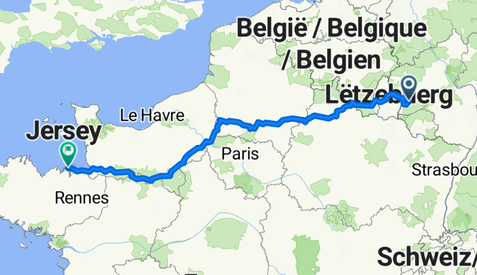
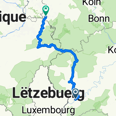
Von Trier bis Saint-Malo
A cycling route starting in Trier, Rhineland-Palatinate, Germany.
Overview
About this route
- 56 h 28 min
- Duration
- 916.1 km
- Distance
- 7,005 m
- Ascent
- 7,125 m
- Descent
- 16.2 km/h
- Avg. speed
- 391 m
- Max. altitude
Route quality
Waytypes & surfaces along the route
Waytypes
Path
284 km
(31 %)
Quiet road
256.5 km
(28 %)
Surfaces
Paved
448.9 km
(49 %)
Unpaved
192.4 km
(21 %)
Asphalt
421.4 km
(46 %)
Gravel
164.9 km
(18 %)
Continue with Bikemap
Use, edit, or download this cycling route
You would like to ride Von Trier bis Saint-Malo or customize it for your own trip? Here is what you can do with this Bikemap route:
Free features
- Save this route as favorite or in collections
- Copy & plan your own version of this route
- Split it into stages to create a multi-day tour
- Sync your route with Garmin or Wahoo
Premium features
Free trial for 3 days, or one-time payment. More about Bikemap Premium.
- Navigate this route on iOS & Android
- Export a GPX / KML file of this route
- Create your custom printout (try it for free)
- Download this route for offline navigation
Discover more Premium features.
Get Bikemap PremiumFrom our community
Other popular routes starting in Trier
 Mosel Radweg Day 3- Final
- Distance
- 122.1 km
- Ascent
- 511 m
- Descent
- 171 m
- Location
- Trier, Rhineland-Palatinate, Germany
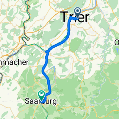 2. Etappe - Graf-Siegfried-Straße, Saarburg nach Heinertstraße, Mettlach
- Distance
- 24.3 km
- Ascent
- 166 m
- Descent
- 139 m
- Location
- Trier, Rhineland-Palatinate, Germany
 Trier Stadtrunde
- Distance
- 8 km
- Ascent
- 28 m
- Descent
- 29 m
- Location
- Trier, Rhineland-Palatinate, Germany
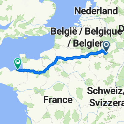 Von Trier bis Saint-Malo
- Distance
- 916.1 km
- Ascent
- 7,005 m
- Descent
- 7,125 m
- Location
- Trier, Rhineland-Palatinate, Germany
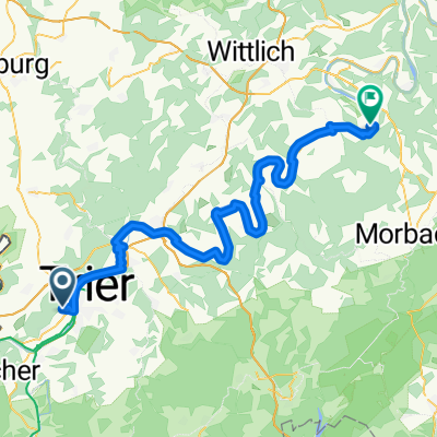 Tag6 Von Trier bis Bernkastel-Kues
- Distance
- 74.3 km
- Ascent
- 672 m
- Descent
- 691 m
- Location
- Trier, Rhineland-Palatinate, Germany
 2018 Trier - Luxemburg - Laon - Amiens - Caen - Le Mont-Saint-Michel - St.Malo - Brest - Nantes
- Distance
- 1,877.5 km
- Ascent
- 1,181 m
- Descent
- 1,299 m
- Location
- Trier, Rhineland-Palatinate, Germany
 Bahnhofsplatz nach Domhof
- Distance
- 231.7 km
- Ascent
- 3,744 m
- Descent
- 3,707 m
- Location
- Trier, Rhineland-Palatinate, Germany
 Trier - Merzig
- Distance
- 57.3 km
- Ascent
- 324 m
- Descent
- 291 m
- Location
- Trier, Rhineland-Palatinate, Germany
Open it in the app