
Hauptplatz Tulln – Serpentinen von Königstetten Runde von Mauerbach. 🚴♂️🚴
A cycling route starting in Mauerbach, Lower Austria, Austria.
Overview
About this route
- 4 h 28 min
- Duration
- 42.6 km
- Distance
- 452 m
- Ascent
- 452 m
- Descent
- 9.5 km/h
- Avg. speed
- 416 m
- Max. altitude

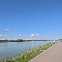
Route photos


Route quality
Waytypes & surfaces along the route
Waytypes
Road
11.5 km
(27 %)
Track
10.6 km
(25 %)
Surfaces
Paved
35.3 km
(83 %)
Unpaved
0.9 km
(2 %)
Asphalt
35.3 km
(83 %)
Gravel
0.4 km
(1 %)
Continue with Bikemap
Use, edit, or download this cycling route
You would like to ride Hauptplatz Tulln – Serpentinen von Königstetten Runde von Mauerbach. 🚴♂️🚴 or customize it for your own trip? Here is what you can do with this Bikemap route:
Free features
- Save this route as favorite or in collections
- Copy & plan your own version of this route
- Sync your route with Garmin or Wahoo
Premium features
Free trial for 3 days, or one-time payment. More about Bikemap Premium.
- Navigate this route on iOS & Android
- Export a GPX / KML file of this route
- Create your custom printout (try it for free)
- Download this route for offline navigation
Discover more Premium features.
Get Bikemap PremiumFrom our community
Other popular routes starting in Mauerbach
 Wienerwaldtrails Hirschengarten-Strecke
- Distance
- 37.8 km
- Ascent
- 969 m
- Descent
- 967 m
- Location
- Mauerbach, Lower Austria, Austria
 In einer Stunde sollte´s gehen ... irgendwann!
- Distance
- 37.8 km
- Ascent
- 702 m
- Descent
- 711 m
- Location
- Mauerbach, Lower Austria, Austria
 ROUTE 3 - MB - Sophienalpe - Dopplerhütte - Katzelsdorf - Tulbinger Kogel
- Distance
- 36.2 km
- Ascent
- 571 m
- Descent
- 570 m
- Location
- Mauerbach, Lower Austria, Austria
 Hauptplatz Tulln – Serpentinen von Königstetten Runde von Mauerbach. 🚴♂️🚴
- Distance
- 42.6 km
- Ascent
- 452 m
- Descent
- 452 m
- Location
- Mauerbach, Lower Austria, Austria
 Kahlenberg-Hameau-Strecke
- Distance
- 63.4 km
- Ascent
- 1,129 m
- Descent
- 1,129 m
- Location
- Mauerbach, Lower Austria, Austria
 Budda Hard
- Distance
- 278.5 km
- Ascent
- 189 m
- Descent
- 367 m
- Location
- Mauerbach, Lower Austria, Austria
 Trainingsrunde Scheiblingstein-Tulln-Wien-Scheiblingstein
- Distance
- 68.5 km
- Ascent
- 520 m
- Descent
- 740 m
- Location
- Mauerbach, Lower Austria, Austria
 Scheiblingstein-Steinbach-Hadersdorf
- Distance
- 21 km
- Ascent
- 389 m
- Descent
- 387 m
- Location
- Mauerbach, Lower Austria, Austria
Open it in the app