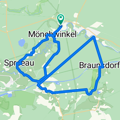
A3K-Cup Zeitfahren 15,721 km
A cycling route starting in Spreenhagen, Brandenburg, Germany.
Overview
About this route
- -:--
- Duration
- 15.7 km
- Distance
- 57 m
- Ascent
- 57 m
- Descent
- ---
- Avg. speed
- 53 m
- Avg. speed
Route quality
Waytypes & surfaces along the route
Waytypes
Road
9.5 km
(61 %)
Busy road
4.8 km
(30 %)
Surfaces
Paved
13.6 km
(87 %)
Unpaved
0.1 km
(<1 %)
Asphalt
13.6 km
(87 %)
Ground
0.1 km
(<1 %)
Undefined
2 km
(13 %)
Continue with Bikemap
Use, edit, or download this cycling route
You would like to ride A3K-Cup Zeitfahren 15,721 km or customize it for your own trip? Here is what you can do with this Bikemap route:
Free features
- Save this route as favorite or in collections
- Copy & plan your own version of this route
- Sync your route with Garmin or Wahoo
Premium features
Free trial for 3 days, or one-time payment. More about Bikemap Premium.
- Navigate this route on iOS & Android
- Export a GPX / KML file of this route
- Create your custom printout (try it for free)
- Download this route for offline navigation
Discover more Premium features.
Get Bikemap PremiumFrom our community
Other popular routes starting in Spreenhagen
- Track Erkner
- Distance
- 66.1 km
- Ascent
- 121 m
- Descent
- 122 m
- Location
- Spreenhagen, Brandenburg, Germany
- Hangelsberg_Berlin_Potsdam
- Distance
- 82.8 km
- Ascent
- 161 m
- Descent
- 171 m
- Location
- Spreenhagen, Brandenburg, Germany
- A3K-Cup Zeitfahren 15,721 km
- Distance
- 15.7 km
- Ascent
- 57 m
- Descent
- 57 m
- Location
- Spreenhagen, Brandenburg, Germany
- Von Erkner bis Reichenwalde
- Distance
- 30.4 km
- Ascent
- 144 m
- Descent
- 140 m
- Location
- Spreenhagen, Brandenburg, Germany
- Hartmannsdorf-Erkner
- Distance
- 13.9 km
- Ascent
- 67 m
- Descent
- 65 m
- Location
- Spreenhagen, Brandenburg, Germany
- Mittelweg 1, Grünheide nach Grünheide (Mark), Grünheide
- Distance
- 9.4 km
- Ascent
- 53 m
- Descent
- 54 m
- Location
- Spreenhagen, Brandenburg, Germany
- Route: 9. Etappe "66-Seen-Wanderweg": Sieger nach Punkten
- Distance
- 22.3 km
- Ascent
- 99 m
- Descent
- 86 m
- Location
- Spreenhagen, Brandenburg, Germany
- Spreetour
- Distance
- 49.2 km
- Ascent
- 105 m
- Descent
- 104 m
- Location
- Spreenhagen, Brandenburg, Germany
Open it in the app