
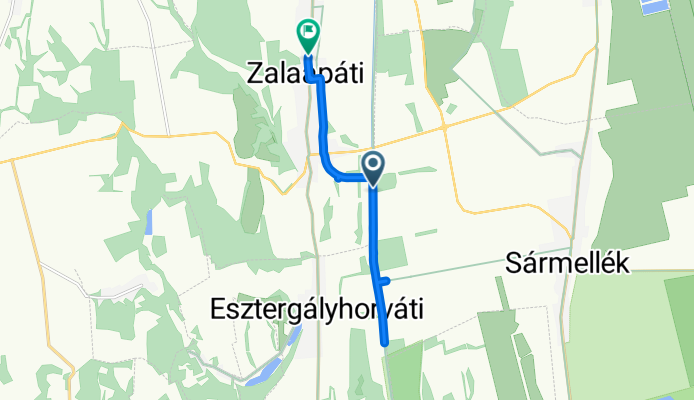
Sármellék - Jókai Mór utca, Zalaapáti
A cycling route starting in Sármellék, Zala County, Hungary.
Overview
About this route
- 57 min
- Duration
- 9.9 km
- Distance
- 44 m
- Ascent
- 29 m
- Descent
- 10.3 km/h
- Avg. speed
- 125 m
- Max. altitude
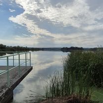
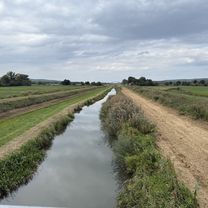
Route photos


Route quality
Waytypes & surfaces along the route
Waytypes
Track
6.5 km
(66 %)
Cycleway
1.4 km
(14 %)
Surfaces
Paved
0.8 km
(8 %)
Unpaved
6 km
(61 %)
Gravel
6 km
(61 %)
Asphalt
0.8 km
(8 %)
Undefined
3.1 km
(31 %)
Continue with Bikemap
Use, edit, or download this cycling route
You would like to ride Sármellék - Jókai Mór utca, Zalaapáti or customize it for your own trip? Here is what you can do with this Bikemap route:
Free features
- Save this route as favorite or in collections
- Copy & plan your own version of this route
- Sync your route with Garmin or Wahoo
Premium features
Free trial for 3 days, or one-time payment. More about Bikemap Premium.
- Navigate this route on iOS & Android
- Export a GPX / KML file of this route
- Create your custom printout (try it for free)
- Download this route for offline navigation
Discover more Premium features.
Get Bikemap PremiumFrom our community
Other popular routes starting in Sármellék
 kisbalaton
- Distance
- 53.7 km
- Ascent
- 219 m
- Descent
- 222 m
- Location
- Sármellék, Zala County, Hungary
 Petőfi Sándor utca - Petőfi Sándor utca
- Distance
- 41.1 km
- Ascent
- 224 m
- Descent
- 270 m
- Location
- Sármellék, Zala County, Hungary
 Kis Balaton kör
- Distance
- 73.6 km
- Ascent
- 150 m
- Descent
- 153 m
- Location
- Sármellék, Zala County, Hungary
 Zalavár, Kis-Balatoni bemutatóház to Zalavár, Kis-Balatoni bemutatóház
- Distance
- 46.8 km
- Ascent
- 421 m
- Descent
- 421 m
- Location
- Sármellék, Zala County, Hungary
 Sármellék - Jókai Mór utca, Zalaapáti
- Distance
- 9.9 km
- Ascent
- 44 m
- Descent
- 29 m
- Location
- Sármellék, Zala County, Hungary
 Hídvégi út, Zalavár to Attila utca 1., Hévíz
- Distance
- 22.5 km
- Ascent
- 106 m
- Descent
- 95 m
- Location
- Sármellék, Zala County, Hungary
 Zala utca, Sármellék to József Attila utca, Zalavár
- Distance
- 6.9 km
- Ascent
- 25 m
- Descent
- 35 m
- Location
- Sármellék, Zala County, Hungary
 Balatonmagyaród - Balatonmagyaród
- Distance
- 38.6 km
- Ascent
- 134 m
- Descent
- 135 m
- Location
- Sármellék, Zala County, Hungary
Open it in the app