
石倉町 4-Chōme, 前橋市 a 石倉町 4-Chōme, 前橋市
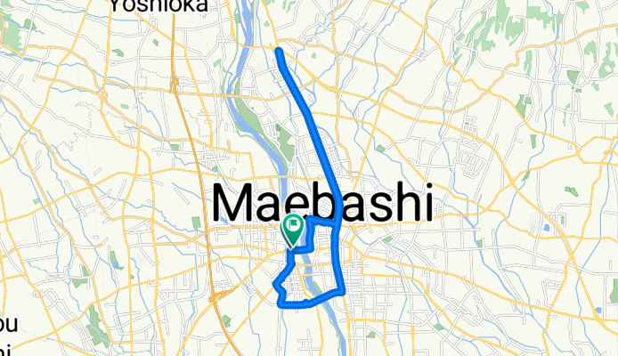
A cycling route starting in Maebashi, Gunma, Japan.
Overview
About this route
Pedalando por Maebashi
- 1 h 53 min
- Duration
- 19.7 km
- Distance
- 105 m
- Ascent
- 94 m
- Descent
- 10.4 km/h
- Avg. speed
- 135 m
- Max. altitude
Continue with Bikemap
Use, edit, or download this cycling route
You would like to ride 石倉町 4-Chōme, 前橋市 a 石倉町 4-Chōme, 前橋市 or customize it for your own trip? Here is what you can do with this Bikemap route:
Free features
- Save this route as favorite or in collections
- Copy & plan your own version of this route
- Sync your route with Garmin or Wahoo
Premium features
Free trial for 3 days, or one-time payment. More about Bikemap Premium.
- Navigate this route on iOS & Android
- Export a GPX / KML file of this route
- Create your custom printout (try it for free)
- Download this route for offline navigation
Discover more Premium features.
Get Bikemap PremiumFrom our community
Other popular routes starting in Maebashi
 白井宿コース
- Distance
- 39 km
- Ascent
- 362 m
- Descent
- 358 m
- Location
- Maebashi, Gunma, Japan
 市街地~敷島周遊コース
- Distance
- 11.9 km
- Ascent
- 55 m
- Descent
- 56 m
- Location
- Maebashi, Gunma, Japan
 国領町 2-Chōme, 前橋市 a 国領町 2-Chōme, 前橋市
- Distance
- 92.9 km
- Ascent
- 1,676 m
- Descent
- 1,676 m
- Location
- Maebashi, Gunma, Japan
 gunma
gunma- Distance
- 109.6 km
- Ascent
- 2,096 m
- Descent
- 2,094 m
- Location
- Maebashi, Gunma, Japan
 Maebashi to Sakura Riverside Park, Kumagaya
- Distance
- 56.5 km
- Ascent
- 66 m
- Descent
- 157 m
- Location
- Maebashi, Gunma, Japan
 19-10, Wakamiyacho 4-Chōme, Maebashi to 1381, Koyaharamachi, Maebashi
- Distance
- 40 km
- Ascent
- 0 m
- Descent
- 36 m
- Location
- Maebashi, Gunma, Japan
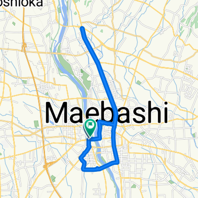 石倉町 4-Chōme, 前橋市 a 石倉町 4-Chōme, 前橋市
- Distance
- 19.7 km
- Ascent
- 105 m
- Descent
- 94 m
- Location
- Maebashi, Gunma, Japan
 石倉町 4-Chōme, 前橋市 a 石倉町 4-Chōme, 前橋市
- Distance
- 30.6 km
- Ascent
- 242 m
- Descent
- 241 m
- Location
- Maebashi, Gunma, Japan
Open it in the app