
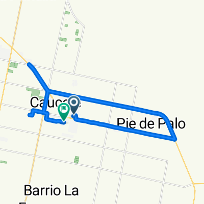
De Laprida a José M. Estrada
A cycling route starting in Caucete, San Juan Province, Argentina.
Overview
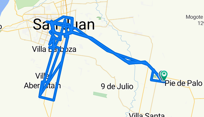
About this route
- 52 h 54 min
- Duration
- 395.9 km
- Distance
- 6,949 m
- Ascent
- 6,941 m
- Descent
- 7.5 km/h
- Avg. speed
- 843 m
- Max. altitude
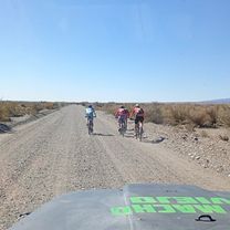
Route photos


Continue with Bikemap
Use, edit, or download this cycling route
You would like to ride De Laprida a José M. Estrada or customize it for your own trip? Here is what you can do with this Bikemap route:
Free features
- Save this route as favorite or in collections
- Copy & plan your own version of this route
- Split it into stages to create a multi-day tour
- Sync your route with Garmin or Wahoo
Premium features
Free trial for 3 days, or one-time payment. More about Bikemap Premium.
- Navigate this route on iOS & Android
- Export a GPX / KML file of this route
- Create your custom printout (try it for free)
- Download this route for offline navigation
Discover more Premium features.
Get Bikemap PremiumFrom our community
Other popular routes starting in Caucete
 De Laprida a José M. Estrada
- Distance
- 395.9 km
- Ascent
- 6,949 m
- Descent
- 6,941 m
- Location
- Caucete, San Juan Province, Argentina
 objetivo 39
- Distance
- 28.8 km
- Ascent
- 226 m
- Descent
- 253 m
- Location
- Caucete, San Juan Province, Argentina
 objetivo 45
- Distance
- 43.7 km
- Ascent
- 292 m
- Descent
- 337 m
- Location
- Caucete, San Juan Province, Argentina
 san ceferino
- Distance
- 27.4 km
- Ascent
- 397 m
- Descent
- 397 m
- Location
- Caucete, San Juan Province, Argentina
 objetivo 22
- Distance
- 29.3 km
- Ascent
- 495 m
- Descent
- 530 m
- Location
- Caucete, San Juan Province, Argentina
 objetivo 49
- Distance
- 25.2 km
- Ascent
- 195 m
- Descent
- 221 m
- Location
- Caucete, San Juan Province, Argentina
 objetivo 22
- Distance
- 27 km
- Ascent
- 241 m
- Descent
- 254 m
- Location
- Caucete, San Juan Province, Argentina
 objetivo 22
- Distance
- 42.5 km
- Ascent
- 475 m
- Descent
- 507 m
- Location
- Caucete, San Juan Province, Argentina
Open it in the app