![서둔동 238-41Ph0]으로 라우팅](/_next/static/media/contour-lines-light-small.cafd5e5d.avif)
![서둔동 238-41Ph0]으로 라우팅](https://media.bikemap.net/routes/17517049/staticmaps/in_1f6049c9-6485-4cc9-b591-e9d47496d9d6_694x400_bikemap-2021-3D-static.png)
서둔동 238-41Ph0]으로 라우팅
A cycling route starting in Suwon-si, Gyeonggi-do, South Korea.
Overview
About this route
- 37 min
- Duration
- 6.5 km
- Distance
- 63 m
- Ascent
- 69 m
- Descent
- 10.5 km/h
- Avg. speed
- 58 m
- Max. altitude
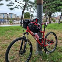
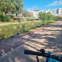
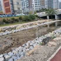
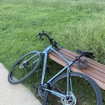
Route photos
![Photo 1 of the Bikemap route "서둔동 238-41Ph0]으로 라우팅"](https://media.bikemap.net/routes/17517049/gallery/thumbs/aea2c698-1d97-45f9-bfae-1dcd7d32e16e.jpg.688x400_q80_crop.jpg "Photo 1 of the Bikemap route \"서둔동 238-41Ph0]으로 라우팅\"")
![Photo 2 of the Bikemap route "서둔동 238-41Ph0]으로 라우팅"](https://media.bikemap.net/routes/17517049/gallery/thumbs/7957dbe8-4e5d-4343-8086-4c1531ab2b13.jpg.688x400_q80_crop.jpg "Photo 2 of the Bikemap route \"서둔동 238-41Ph0]으로 라우팅\"")
![Photo 3 of the Bikemap route "서둔동 238-41Ph0]으로 라우팅"](https://media.bikemap.net/routes/17517049/gallery/thumbs/dd639561-d06f-4418-9953-a708808e897f.jpg.208x208_q80_crop.jpg "Photo 3 of the Bikemap route \"서둔동 238-41Ph0]으로 라우팅\"")
Continue with Bikemap
Use, edit, or download this cycling route
You would like to ride 서둔동 238-41Ph0]으로 라우팅 or customize it for your own trip? Here is what you can do with this Bikemap route:
Free features
- Save this route as favorite or in collections
- Copy & plan your own version of this route
- Sync your route with Garmin or Wahoo
Premium features
Free trial for 3 days, or one-time payment. More about Bikemap Premium.
- Navigate this route on iOS & Android
- Export a GPX / KML file of this route
- Create your custom printout (try it for free)
- Download this route for offline navigation
Discover more Premium features.
Get Bikemap PremiumFrom our community
Other popular routes starting in Suwon-si
 망포동 ~ 신갈ㆍ기흥호수공원
- Distance
- 18 km
- Ascent
- 145 m
- Descent
- 160 m
- Location
- Suwon-si, Gyeonggi-do, South Korea
![서둔동 238-41Ph0]으로 라우팅](https://media.bikemap.net/routes/17517049/gallery/thumbs/aea2c698-1d97-45f9-bfae-1dcd7d32e16e.jpg.208x208_q80_crop.jpg) 서둔동 238-41Ph0]으로 라우팅
서둔동 238-41Ph0]으로 라우팅- Distance
- 6.5 km
- Ascent
- 63 m
- Descent
- 69 m
- Location
- Suwon-si, Gyeonggi-do, South Korea
 보통 경로
보통 경로- Distance
- 38.9 km
- Ascent
- 175 m
- Descent
- 241 m
- Location
- Suwon-si, Gyeonggi-do, South Korea
 느린 주행
느린 주행- Distance
- 10 km
- Ascent
- 51 m
- Descent
- 67 m
- Location
- Suwon-si, Gyeonggi-do, South Korea
![Ph0]에서 경로구운동](https://media.bikemap.net/routes/17767375/staticmaps/in_e1a2b0c8-eacb-423f-ba03-6bd4e4fd41dc_400x400_bikemap-2021-3D-static.png) Ph0]에서 경로구운동
Ph0]에서 경로구운동- Distance
- 40.4 km
- Ascent
- 264 m
- Descent
- 219 m
- Location
- Suwon-si, Gyeonggi-do, South Korea
 편안한 경로
- Distance
- 9.9 km
- Ascent
- 36 m
- Descent
- 64 m
- Location
- Suwon-si, Gyeonggi-do, South Korea
 죽전로 ~ 죽전동
- Distance
- 14.2 km
- Ascent
- 122 m
- Descent
- 156 m
- Location
- Suwon-si, Gyeonggi-do, South Korea
 동백동, 용인시에서 압구정동, 서울특별시까지
- Distance
- 37.9 km
- Ascent
- 79 m
- Descent
- 178 m
- Location
- Suwon-si, Gyeonggi-do, South Korea
Open it in the app