Rund um den Kreutzberg
A cycling route starting in Bad Bocklet, Bavaria, Germany.
Overview
About this route
re
- -:--
- Duration
- 68.6 km
- Distance
- 1,156 m
- Ascent
- 1,147 m
- Descent
- ---
- Avg. speed
- ---
- Avg. speed
Route quality
Waytypes & surfaces along the route
Waytypes
Busy road
39.1 km
(57 %)
Road
27.3 km
(40 %)
Surfaces
Paved
50 km
(73 %)
Unpaved
0.4 km
(<1 %)
Asphalt
50 km
(73 %)
Gravel
0.3 km
(<1 %)
Continue with Bikemap
Use, edit, or download this cycling route
You would like to ride Rund um den Kreutzberg or customize it for your own trip? Here is what you can do with this Bikemap route:
Free features
- Save this route as favorite or in collections
- Copy & plan your own version of this route
- Sync your route with Garmin or Wahoo
Premium features
Free trial for 3 days, or one-time payment. More about Bikemap Premium.
- Navigate this route on iOS & Android
- Export a GPX / KML file of this route
- Create your custom printout (try it for free)
- Download this route for offline navigation
Discover more Premium features.
Get Bikemap PremiumFrom our community
Other popular routes starting in Bad Bocklet
- Tag 1 2019 - Bad Bocklet/Gemünden
- Distance
- 64.2 km
- Ascent
- 214 m
- Descent
- 278 m
- Location
- Bad Bocklet, Bavaria, Germany
- Bad Bocklet - Waldsassen
- Distance
- 468.3 km
- Ascent
- 1,568 m
- Descent
- 1,573 m
- Location
- Bad Bocklet, Bavaria, Germany
- Rund um den Kreutzberg
- Distance
- 68.6 km
- Ascent
- 1,156 m
- Descent
- 1,147 m
- Location
- Bad Bocklet, Bavaria, Germany
- Landkreisumrundung Tag 3 von Steinach nach Oberweisenbrunn
- Distance
- 31.7 km
- Ascent
- 793 m
- Descent
- 422 m
- Location
- Bad Bocklet, Bavaria, Germany
- Jakobsweg windheim - Saint Pied de port
- Distance
- 1,812.4 km
- Ascent
- 2,272 m
- Descent
- 2,459 m
- Location
- Bad Bocklet, Bavaria, Germany
- Dionysiusstraße 6, Bad Kissingen nach Dionysiusstraße 1, Bad Kissingen
- Distance
- 14.8 km
- Ascent
- 263 m
- Descent
- 263 m
- Location
- Bad Bocklet, Bavaria, Germany
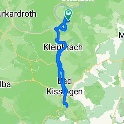
- Aschach - Kreuzberg - Aschach
- Distance
- 55.3 km
- Ascent
- 959 m
- Descent
- 956 m
- Location
- Bad Bocklet, Bavaria, Germany
- Bad Bocklet bis Lohr am Main
- Distance
- 87.2 km
- Ascent
- 262 m
- Descent
- 309 m
- Location
- Bad Bocklet, Bavaria, Germany
Open it in the app