
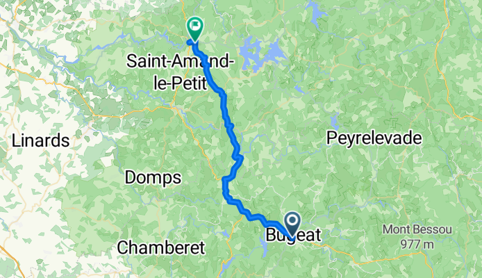
Bugeat to Peyrat-le-Château
A cycling route starting in Bugeat, Nouvelle-Aquitaine, France.
Overview
About this route
This route was excellent. The first part was on an arterial with little to no road shoulder, but there was so little traffic that it didn't matter. After getting on to D132 from D940, the remainder of the ride was on low/zero traffic roads. Excellent. Nice scenery.
- 5 h 22 min
- Duration
- 38.7 km
- Distance
- 464 m
- Ascent
- 756 m
- Descent
- 7.2 km/h
- Avg. speed
- 745 m
- Max. altitude

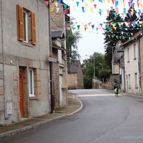
Route photos


Route quality
Waytypes & surfaces along the route
Waytypes
Road
22.5 km
(58 %)
Quiet road
1.2 km
(3 %)
Undefined
15.1 km
(39 %)
Surfaces
Paved
20.1 km
(52 %)
Asphalt
20.1 km
(52 %)
Undefined
18.6 km
(48 %)
Continue with Bikemap
Use, edit, or download this cycling route
You would like to ride Bugeat to Peyrat-le-Château or customize it for your own trip? Here is what you can do with this Bikemap route:
Free features
- Save this route as favorite or in collections
- Copy & plan your own version of this route
- Sync your route with Garmin or Wahoo
Premium features
Free trial for 3 days, or one-time payment. More about Bikemap Premium.
- Navigate this route on iOS & Android
- Export a GPX / KML file of this route
- Create your custom printout (try it for free)
- Download this route for offline navigation
Discover more Premium features.
Get Bikemap PremiumFrom our community
Other popular routes starting in Bugeat
 test
test- Distance
- 100.2 km
- Ascent
- 1,170 m
- Descent
- 1,034 m
- Location
- Bugeat, Nouvelle-Aquitaine, France
![[Itinéraire] Les Vestiges Gallo-Romains des Mazières](https://media.bikemap.net/routes/10303975/staticmaps/in_54b629bc-690a-4f3d-b44e-93393eeaf550_400x400_bikemap-2021-3D-static.png) [Itinéraire] Les Vestiges Gallo-Romains des Mazières
[Itinéraire] Les Vestiges Gallo-Romains des Mazières- Distance
- 3 km
- Ascent
- 62 m
- Descent
- 59 m
- Location
- Bugeat, Nouvelle-Aquitaine, France
 Etape 03 - Bugeat à Bar - 43km 320D+
- Distance
- 43.1 km
- Ascent
- 293 m
- Descent
- 696 m
- Location
- Bugeat, Nouvelle-Aquitaine, France
 11/16 Bugeat - Uzerche
- Distance
- 49.8 km
- Ascent
- 354 m
- Descent
- 705 m
- Location
- Bugeat, Nouvelle-Aquitaine, France
 Peyrelevade Sedières (Clergoux) 68 km
- Distance
- 68.8 km
- Ascent
- 516 m
- Descent
- 737 m
- Location
- Bugeat, Nouvelle-Aquitaine, France
 05_tarnac-fr_dohan-be
- Distance
- 694.6 km
- Ascent
- 1,287 m
- Descent
- 1,737 m
- Location
- Bugeat, Nouvelle-Aquitaine, France
 Bugeat to Peyrat-le-Château
- Distance
- 38.7 km
- Ascent
- 464 m
- Descent
- 756 m
- Location
- Bugeat, Nouvelle-Aquitaine, France
 Bugeat to La Chausee
- Distance
- 253.6 km
- Ascent
- 477 m
- Descent
- 1,153 m
- Location
- Bugeat, Nouvelle-Aquitaine, France
Open it in the app