La Graverie - Campeaux
A cycling route starting in Vaudry, Normandy, France.
Overview
About this route
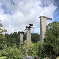
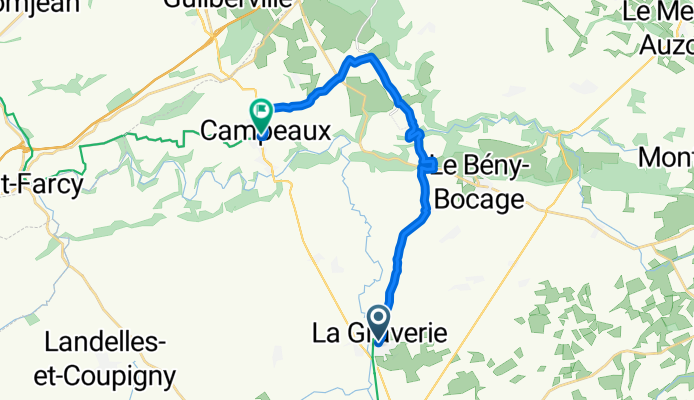
Due to unforeseen circumstances, the route does not follow exactly from the previous. The recorded route begins in La Graverie (outside Vire) and continues on the EuroVélo 4 to Campeaux. The old railway line has been left behind and quiet country roads now lead by way of several demanding steep descents and ascents before reaching the small village of Campeaux.
- 2 h 34 min
- Duration
- 16.7 km
- Distance
- 311 m
- Ascent
- 263 m
- Descent
- 6.5 km/h
- Avg. speed
- 179 m
- Max. altitude
Route photos
Route quality
Waytypes & surfaces along the route
Waytypes
Quiet road
8.9 km
(53 %)
Road
6.7 km
(40 %)
Surfaces
Paved
8.4 km
(50 %)
Unpaved
0.3 km
(2 %)
Asphalt
8.4 km
(50 %)
Gravel
0.3 km
(2 %)
Undefined
8 km
(48 %)
Continue with Bikemap
Use, edit, or download this cycling route
You would like to ride La Graverie - Campeaux or customize it for your own trip? Here is what you can do with this Bikemap route:
Free features
- Save this route as favorite or in collections
- Copy & plan your own version of this route
- Sync your route with Garmin or Wahoo
Premium features
Free trial for 3 days, or one-time payment. More about Bikemap Premium.
- Navigate this route on iOS & Android
- Export a GPX / KML file of this route
- Create your custom printout (try it for free)
- Download this route for offline navigation
Discover more Premium features.
Get Bikemap PremiumFrom our community
Other popular routes starting in Vaudry
- Route de la Galonnière 115, Vire-Normandie to Chemin de la Cambette 4, Bayeux
- Distance
- 69.5 km
- Ascent
- 1,033 m
- Descent
- 1,161 m
- Location
- Vaudry, Normandy, France
- Itinéraire modéré en Saint-Manvieu-Bocage
- Distance
- 19 km
- Ascent
- 171 m
- Descent
- 221 m
- Location
- Vaudry, Normandy, France
- genniere
- Distance
- 0.1 km
- Ascent
- 0 m
- Descent
- 0 m
- Location
- Vaudry, Normandy, France
- Domfort
- Distance
- 50.2 km
- Ascent
- 627 m
- Descent
- 567 m
- Location
- Vaudry, Normandy, France
- Rue de la Touyonne, Vire Normandie à Rue de la Touyonne, Vire Normandie
- Distance
- 6.8 km
- Ascent
- 98 m
- Descent
- 96 m
- Location
- Vaudry, Normandy, France
- Day 5
- Distance
- 62.8 km
- Ascent
- 286 m
- Descent
- 354 m
- Location
- Vaudry, Normandy, France
- La Graverie - Campeaux
- Distance
- 16.7 km
- Ascent
- 311 m
- Descent
- 263 m
- Location
- Vaudry, Normandy, France
- Route de la Galonnière 115, Vire-Normandie to Impasse Prudhomme 1, Bayeux
- Distance
- 63.8 km
- Ascent
- 652 m
- Descent
- 730 m
- Location
- Vaudry, Normandy, France
Open it in the app