- 7.1 km
- 144 m
- 139 m
- Saint-Martin-des-Besaces, Normandy, France
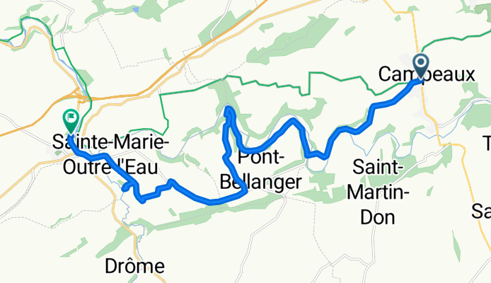
Campeaux - Pont-Farcy
A cycling route starting in Saint-Martin-des-Besaces, Normandy, France.
Overview
About this route
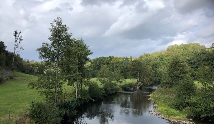
Quiet country roads continue to form the route to Pont-Farcy through lovely Normandy countryside. Any climbs are now fewer and less demanding. A short distance from the day's destination, the Grotte de Bion in Sainte-Marie-Outre-l'Eau is of interest and does not involve too long a walk from the roadside.
- 1 h 20 min
- Duration
- 14.5 km
- Distance
- 199 m
- Ascent
- 297 m
- Descent
- 10.9 km/h
- Avg. speed
- 165 m
- Max. altitude
created this 3 months ago
Route photos
Route quality
Waytypes & surfaces along the route
Waytypes
Quiet road
7.7 km
(53 %)
Road
5.5 km
(38 %)
Surfaces
Paved
2.6 km
(18 %)
Unpaved
0.7 km
(5 %)
Asphalt
2.6 km
(18 %)
Gravel
0.7 km
(5 %)
Undefined
11.2 km
(77 %)
Continue with Bikemap
Use, edit, or download this cycling route
You would like to ride Campeaux - Pont-Farcy or customize it for your own trip? Here is what you can do with this Bikemap route:
Free features
- Save this route as favorite or in collections
- Copy & plan your own version of this route
- Sync your route with Garmin or Wahoo
Premium features
Free trial for 3 days, or one-time payment. More about Bikemap Premium.
- Navigate this route on iOS & Android
- Export a GPX / KML file of this route
- Create your custom printout (try it for free)
- Download this route for offline navigation
Discover more Premium features.
Get Bikemap PremiumFrom our community
Other popular routes starting in Saint-Martin-des-Besaces
- 11 Rue de la 11ème Division Blindée Britannique, Souleuvre en Bocage to Eurovélo Quatre - Véloroute de l'Europe Centrale, Souleuvre en Bocage
- vers l étape en forêt
- 27.6 km
- 391 m
- 327 m
- Saint-Martin-des-Besaces, Normandy, France
- LA FERRIERE HARANG-BRAY DUNES
- 464 km
- 774 m
- 943 m
- Saint-Martin-des-Besaces, Normandy, France
- De Place du Marché 1, Saint-Martin-des-Besaces à La Robigière, Saint-Denis-Maisoncelles
- 9.4 km
- 142 m
- 160 m
- Saint-Martin-des-Besaces, Normandy, France
- Campeaux - Pont-Farcy
- 14.5 km
- 199 m
- 297 m
- Saint-Martin-des-Besaces, Normandy, France
- La Ferriere Harang - Vire
- 18.2 km
- 178 m
- 232 m
- Saint-Martin-des-Besaces, Normandy, France
- Le Bény-Bocage, Souleuvre en Bocage to 2–8 Rue Larcher, Bayeux
- 55.7 km
- 587 m
- 677 m
- Saint-Martin-des-Besaces, Normandy, France
- De 17 Rue de la 11ème Division Blindée Britannique, Le Bény-Bocage à 3 Place Docteur Jean Maugeais, Le Bény-Bocage
- 0.3 km
- 3 m
- 0 m
- Saint-Martin-des-Besaces, Normandy, France
Open it in the app


