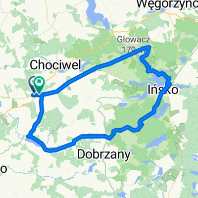
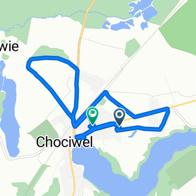
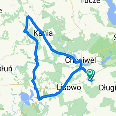
From Gmina Chociwel to Gartz (Oder)
A cycling route starting in Chociwel, West Pomeranian Voivodeship, Poland.
Overview
About this route
- 6 h 57 min
- Duration
- 105.2 km
- Distance
- 567 m
- Ascent
- 680 m
- Descent
- 15.1 km/h
- Avg. speed
- 140 m
- Max. altitude
Route quality
Waytypes & surfaces along the route
Waytypes
- Quiet road - 49.4 km - (47 %) 
- Track - 23.1 km - (22 %) 
Surfaces
Paved
64.2 km
(61 %)
Unpaved
16.8 km
(16 %)
- Asphalt - 61 km - (58 %) 
- Gravel - 12.6 km - (12 %) 
Continue with Bikemap
Use, edit, or download this cycling route
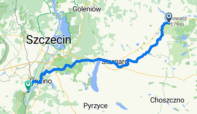
You would like to ride From Gmina Chociwel to Gartz (Oder) or customize it for your own trip? Here is what you can do with this Bikemap route:
Free features
- Save this route as favorite or in collections
- Copy & plan your own version of this route
- Split it into stages to create a multi-day tour
- Sync your route with Garmin or Wahoo
Premium features
Free trial for 3 days, or one-time payment. More about Bikemap Premium.
- Navigate this route on iOS & Android
- Export a GPX / KML file of this route
- Create your custom printout (try it for free)
- Download this route for offline navigation
Discover more Premium features.
Get Bikemap PremiumFrom our community
Other popular routes starting in Chociwel
 - 3198® Chociwel Cycling- Distance
- 8.7 km
- Ascent
- 13 m
- Descent
- 27 m
- Location
- Chociwel, West Pomeranian Voivodeship, Poland
 
 Starzyce 5b, Chociwel do Starzyce 5b, Chociwel Starzyce 5b, Chociwel do Starzyce 5b, Chociwel- Distance
- 26.5 km
- Ascent
- 559 m
- Descent
- 556 m
- Location
- Chociwel, West Pomeranian Voivodeship, Poland
 
 Wojska Polskiego 1A, Chociwel do Wojska Polskiego 1A, Chociwel Wojska Polskiego 1A, Chociwel do Wojska Polskiego 1A, Chociwel- Distance
- 8.1 km
- Ascent
- 201 m
- Descent
- 207 m
- Location
- Chociwel, West Pomeranian Voivodeship, Poland
 
 Jana Pawła II 25, Chociwel do Armii Krajowej 68, Chociwel Jana Pawła II 25, Chociwel do Armii Krajowej 68, Chociwel- Distance
- 9.8 km
- Ascent
- 337 m
- Descent
- 336 m
- Location
- Chociwel, West Pomeranian Voivodeship, Poland
 
 Chociwel - Dobra Chociwel - Dobra- Distance
- 62.9 km
- Ascent
- 143 m
- Descent
- 147 m
- Location
- Chociwel, West Pomeranian Voivodeship, Poland
 
 Kania 47, Kania do Kania 47, Kania Kania 47, Kania do Kania 47, Kania- Distance
- 15.1 km
- Ascent
- 988 m
- Descent
- 987 m
- Location
- Chociwel, West Pomeranian Voivodeship, Poland
 
 Ińsko - Chociwel Ińsko - Chociwel- Distance
- 60.4 km
- Ascent
- 224 m
- Descent
- 219 m
- Location
- Chociwel, West Pomeranian Voivodeship, Poland
 
 Studzianki, Chociwel do Jana Pawła II 20A, Dobrzany Studzianki, Chociwel do Jana Pawła II 20A, Dobrzany- Distance
- 15.2 km
- Ascent
- 76 m
- Descent
- 79 m
- Location
- Chociwel, West Pomeranian Voivodeship, Poland
 
Open it in the app


