
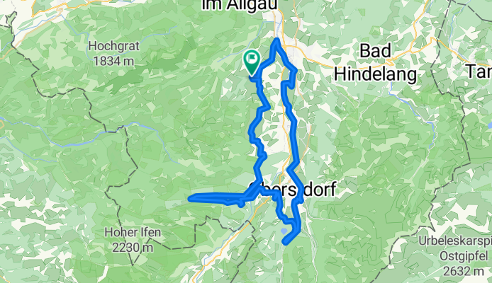
Route in Ofterschwang
A cycling route starting in Ofterschwang, Bavaria, Germany.
Overview
About this route
- 4 h 27 min
- Duration
- 61.1 km
- Distance
- 1,258 m
- Ascent
- 1,257 m
- Descent
- 13.7 km/h
- Avg. speed
- 1,222 m
- Max. altitude
Route quality
Waytypes & surfaces along the route
Waytypes
Quiet road
19.6 km
(32 %)
Path
16.5 km
(27 %)
Surfaces
Paved
36.7 km
(60 %)
Unpaved
20.8 km
(34 %)
Asphalt
34.8 km
(57 %)
Gravel
17.1 km
(28 %)
Continue with Bikemap
Use, edit, or download this cycling route
You would like to ride Route in Ofterschwang or customize it for your own trip? Here is what you can do with this Bikemap route:
Free features
- Save this route as favorite or in collections
- Copy & plan your own version of this route
- Sync your route with Garmin or Wahoo
Premium features
Free trial for 3 days, or one-time payment. More about Bikemap Premium.
- Navigate this route on iOS & Android
- Export a GPX / KML file of this route
- Create your custom printout (try it for free)
- Download this route for offline navigation
Discover more Premium features.
Get Bikemap PremiumFrom our community
Other popular routes starting in Ofterschwang
 OA5 nach Gaisalpe
- Distance
- 13.5 km
- Ascent
- 494 m
- Descent
- 216 m
- Location
- Ofterschwang, Bavaria, Germany
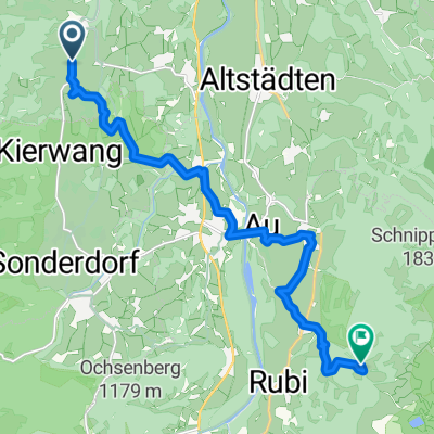
 Ofterschwang zur Alpe Sonthofener Hof
- Distance
- 20.6 km
- Ascent
- 565 m
- Descent
- 566 m
- Location
- Ofterschwang, Bavaria, Germany
 Ferienwohnung Overberg - kurze Powerrunde
- Distance
- 23.6 km
- Ascent
- 848 m
- Descent
- 849 m
- Location
- Ofterschwang, Bavaria, Germany
 OBERSTDORF RUNDE RR
- Distance
- 42.5 km
- Ascent
- 393 m
- Descent
- 392 m
- Location
- Ofterschwang, Bavaria, Germany
 Gunzesried - Bärenköpfle - Mittag - Gschwender Horn - Alpsee - Immenstadt - Gunzesried CLONED FROM ROUTE 84082
- Distance
- 36.4 km
- Ascent
- 1,318 m
- Descent
- 1,309 m
- Location
- Ofterschwang, Bavaria, Germany
 Riebergpaß - die höchste Paßstraße Deutschlands
- Distance
- 43.4 km
- Ascent
- 1,074 m
- Descent
- 853 m
- Location
- Ofterschwang, Bavaria, Germany
 6-1) Stillacherstr. - Illerdamm (Rundweg)
- Distance
- 28.4 km
- Ascent
- 347 m
- Descent
- 345 m
- Location
- Ofterschwang, Bavaria, Germany
 Von Ofterschwang zur Alpe Altstädter Hof
- Distance
- 26.8 km
- Ascent
- 670 m
- Descent
- 670 m
- Location
- Ofterschwang, Bavaria, Germany
Open it in the app